PALM TREE PRODUCTIONS
back to hikes and climbs back to Locations and Travel
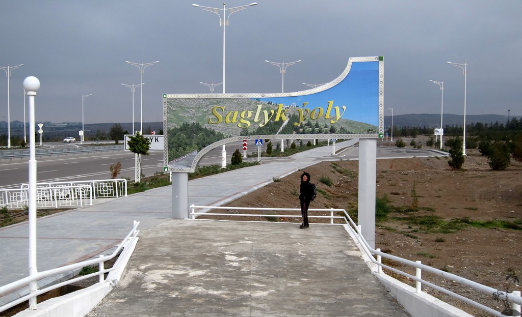
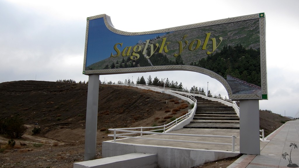
Saglyk Ýoly - The Trail of
Health![]()
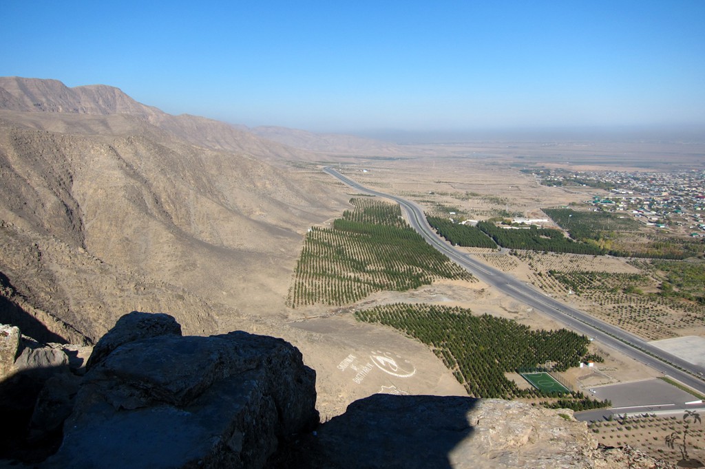
Summary: Taking advantage of a work assignment in Ashgabat, we sought out the famous Health Path Saglyk Yoly. Before arriving we saw its photographs on Google Earth, posted like a string of pearls along the ridge contour of the southern mountain range, the Kopet-Dag.
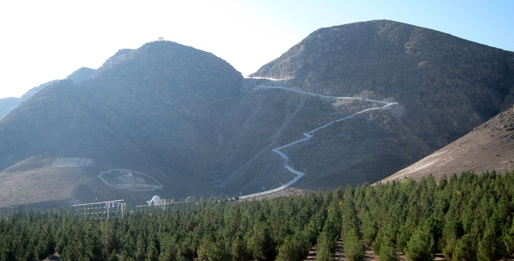
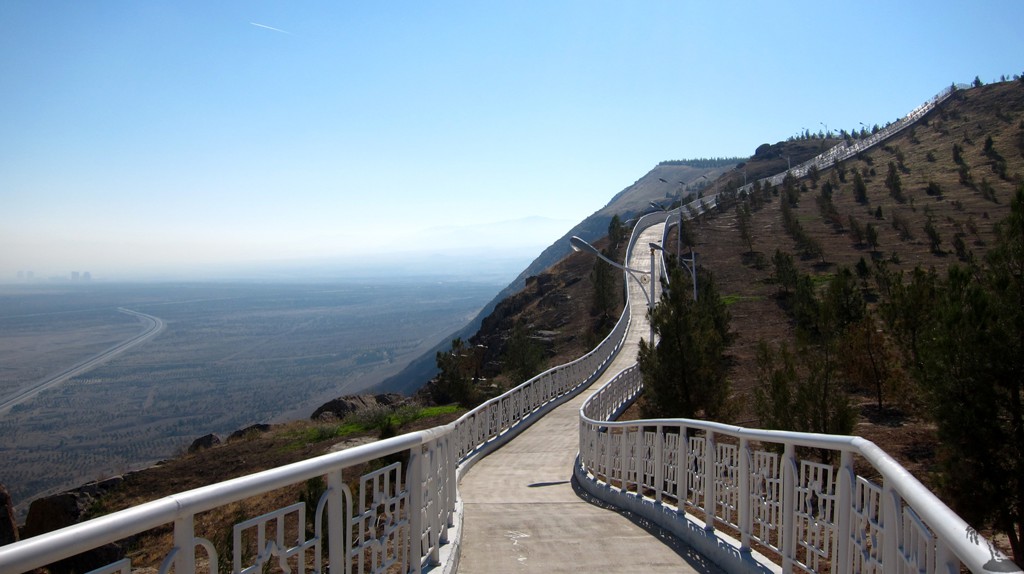
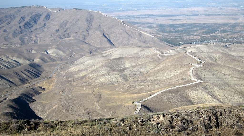
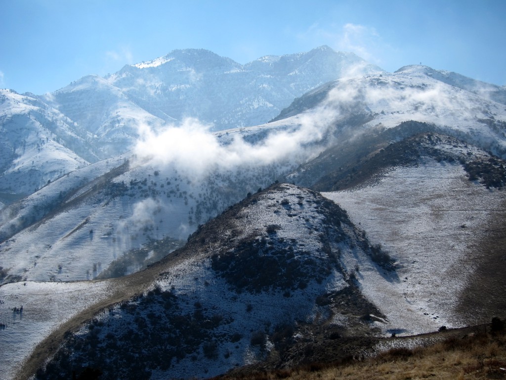
As an encouragement to people to become active and do something for their health and fitness the Turkmen leadership has established a system of improved health trails through the mountains south of Ashgabat, with a total length of more than 30 kilometers.
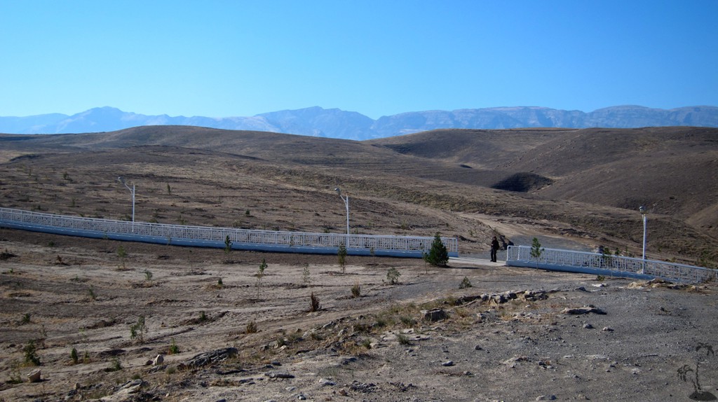
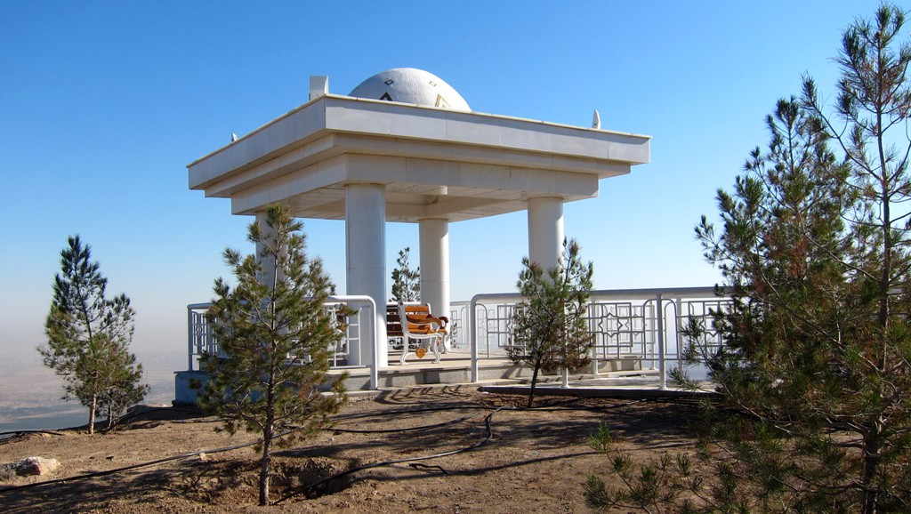
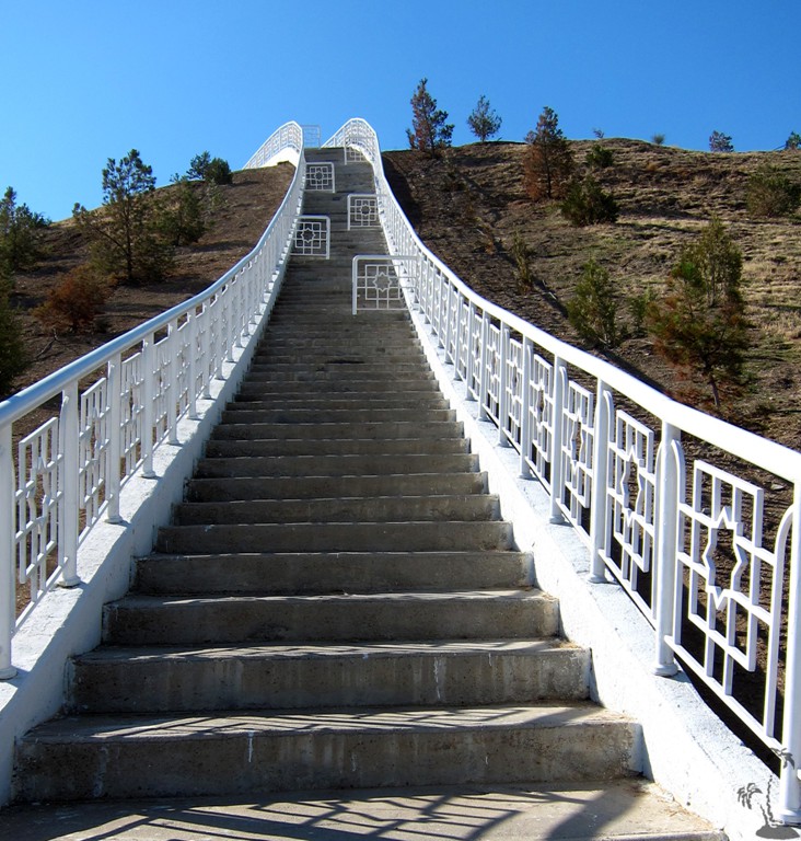
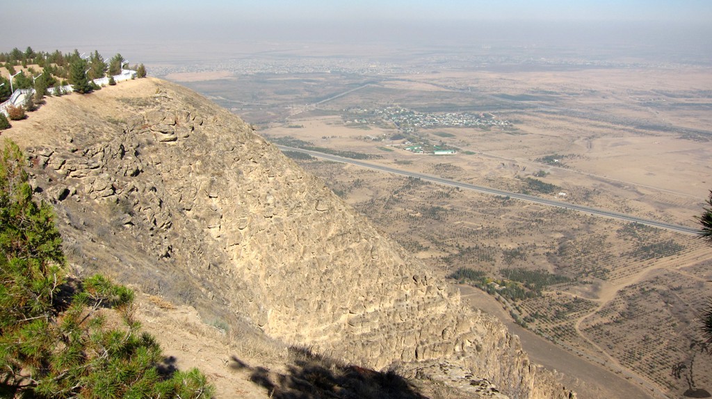
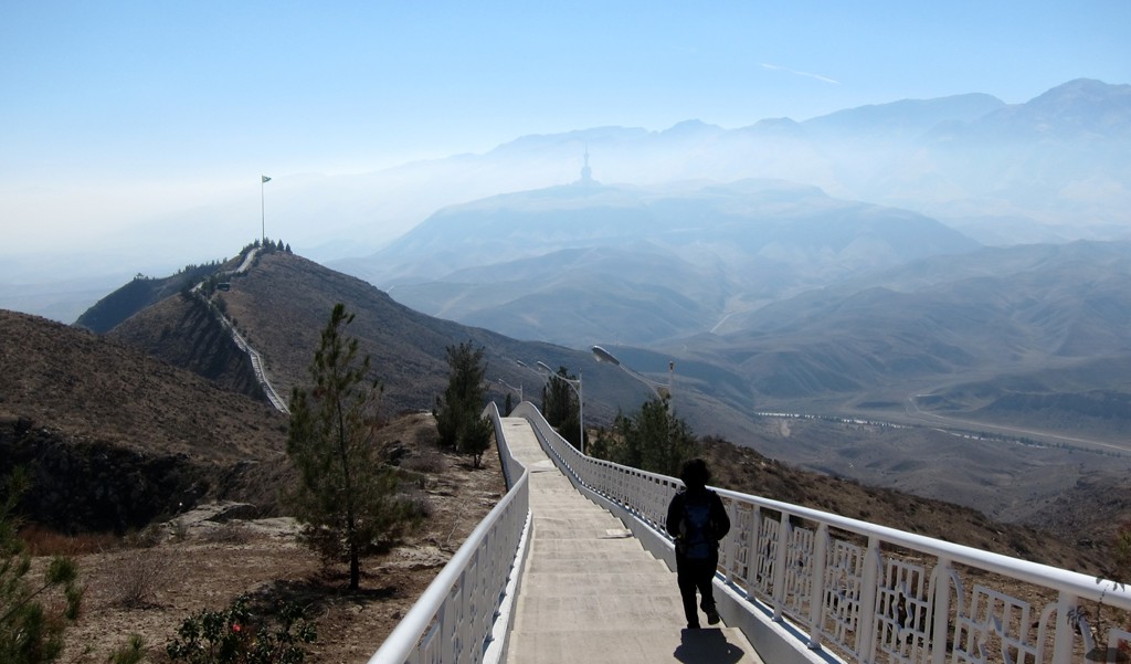
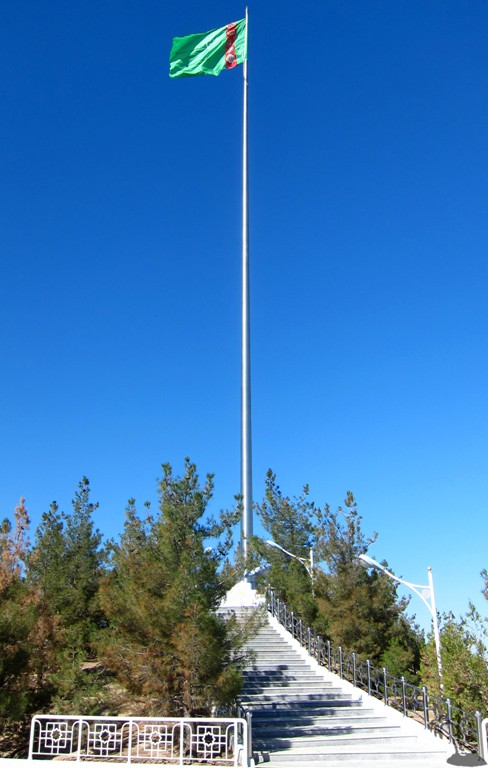
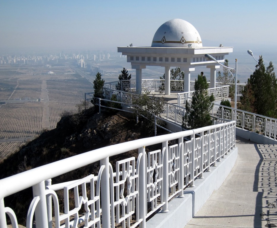
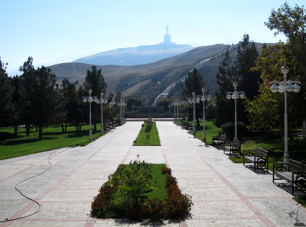
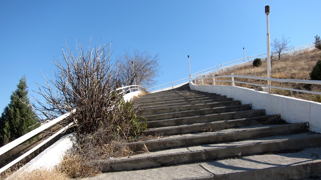
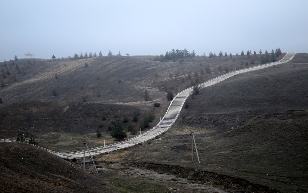
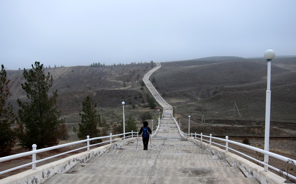
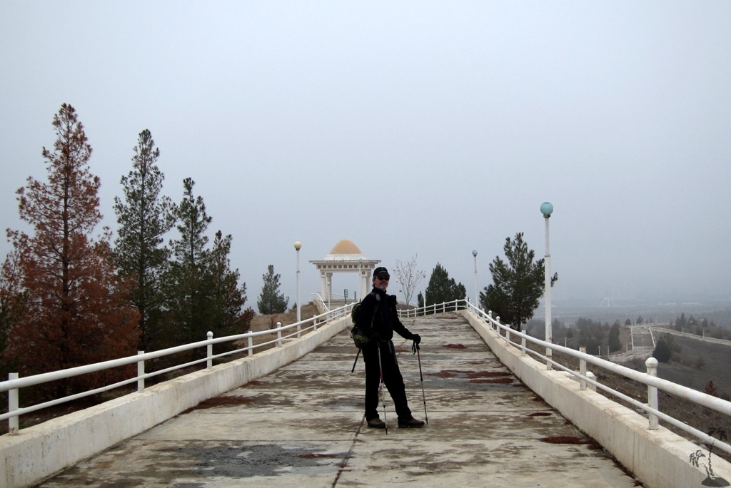
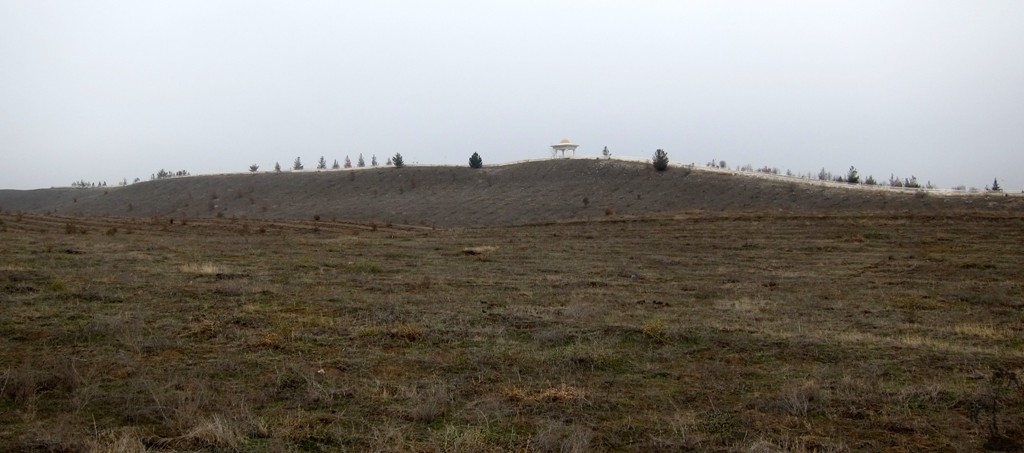
Health Path 1: The shortest - and most interesting and best maintained - trail encompasses 7 km of an elaborate cemented path of about 2 meters width. The Turkmen leadership is not content with simple trailmarkings: both sides are secured with a metallic lattice fence and lit at night with street lanterns - no need to bring your headlamp. The octagonal golden Seljuk star (an eight point star made of two squares) motive appears on fence and lamps and on the domed pavilions that offer shade in summer.
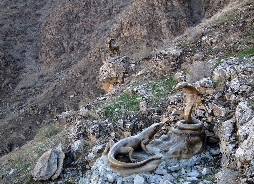
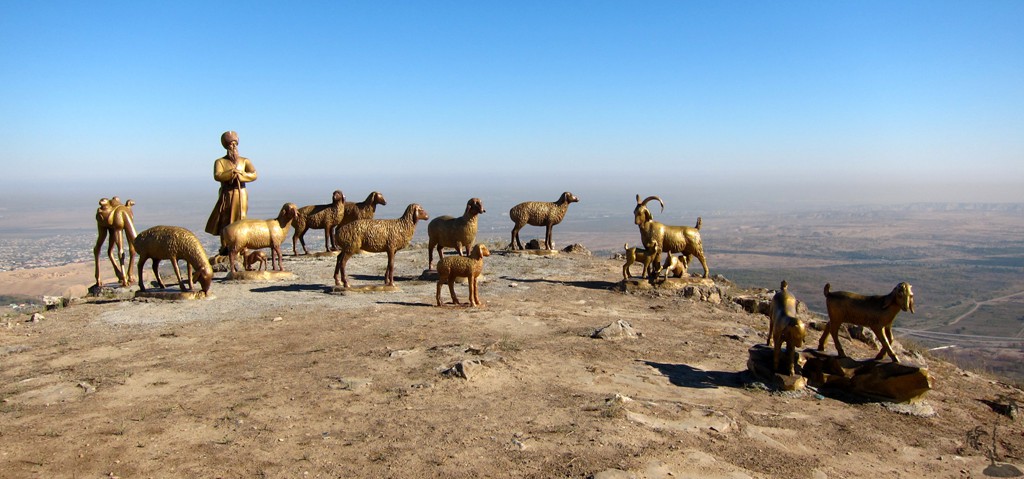
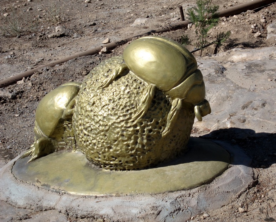
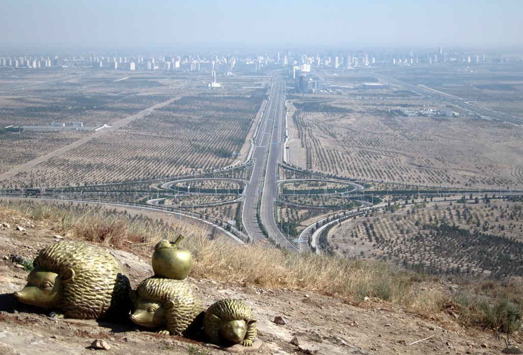
Along the way life size golden statues of common desert animals have been lovingly placed, some constellations reminiscent of fables.
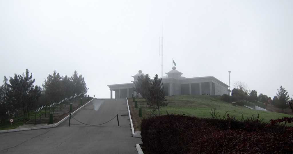
The trail can be interrupted after about eight kilometers, where there is bus station and a kiosk with tea and refreshments. The President of Turmenistan urges his Ministers, once a year, to complete the walk up to here.
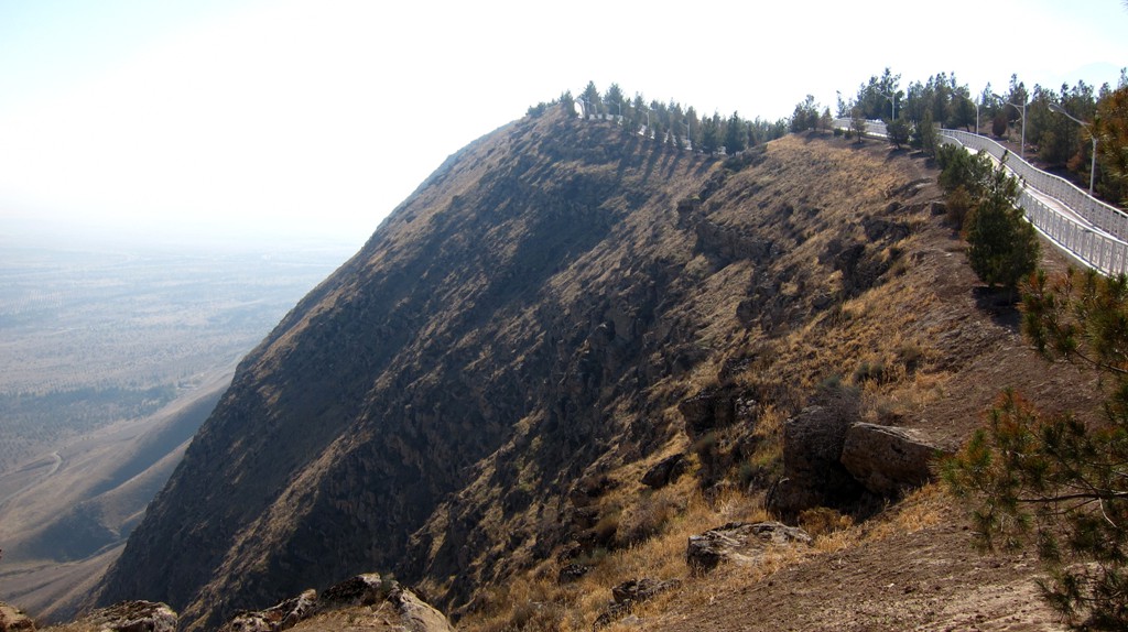
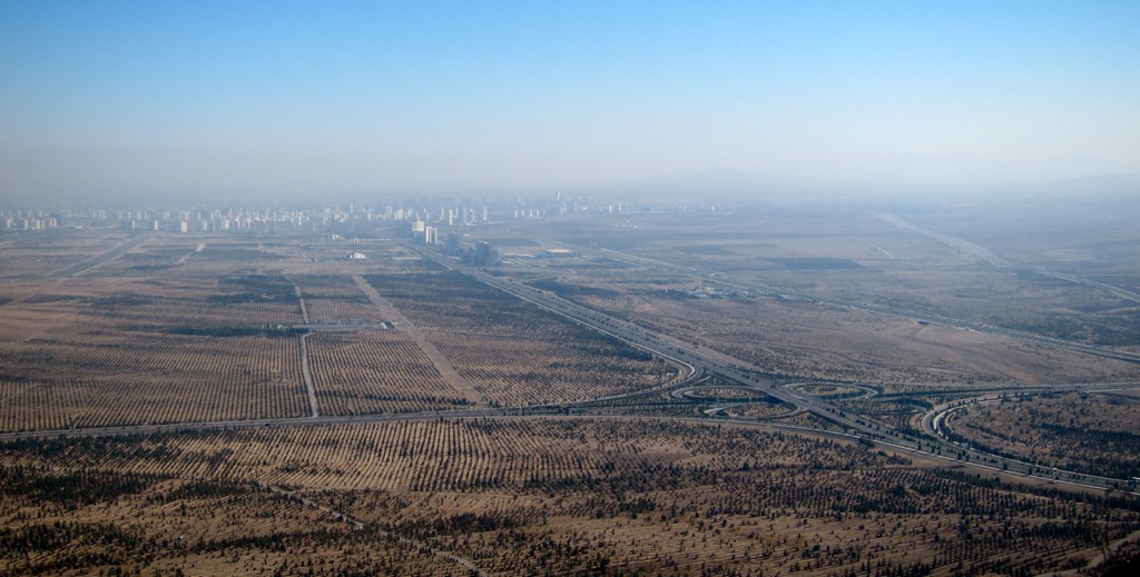
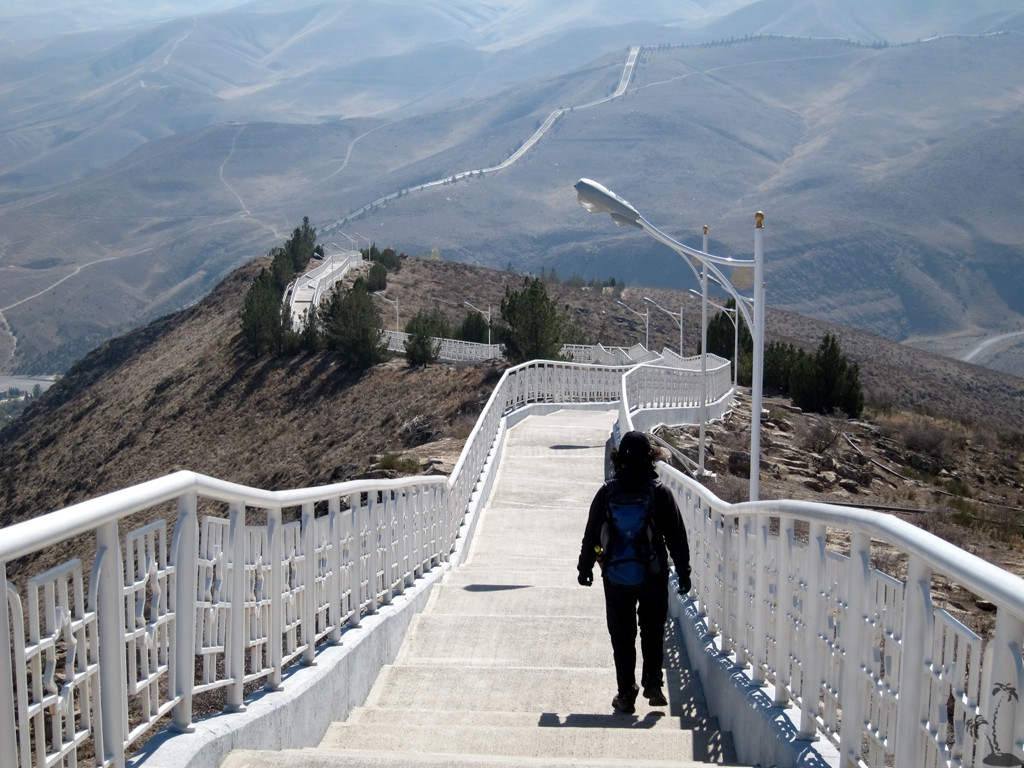
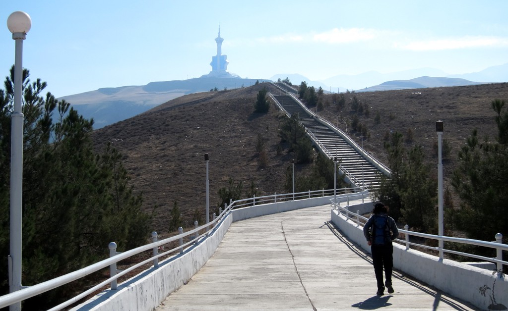
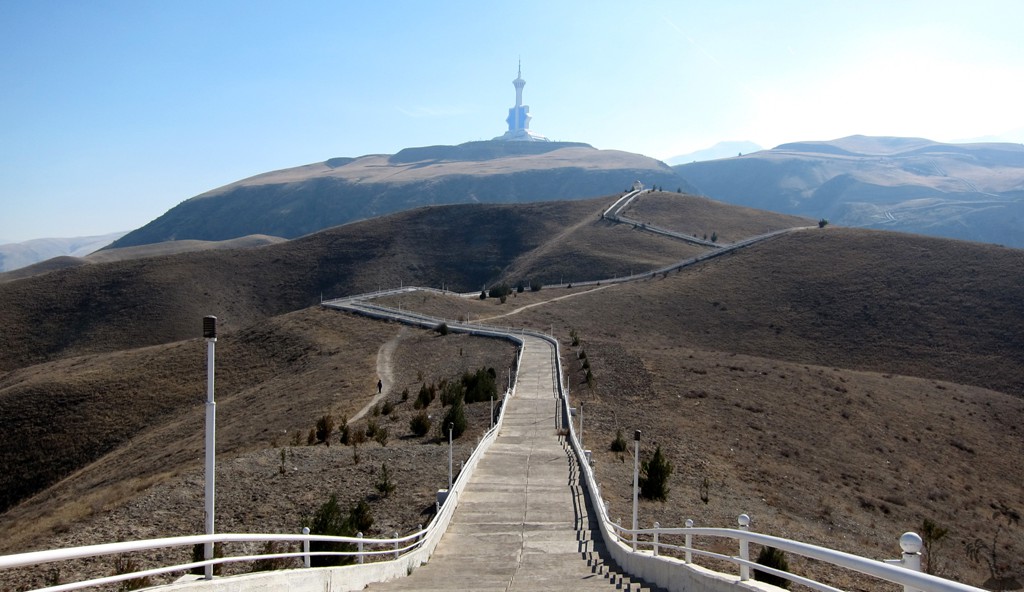
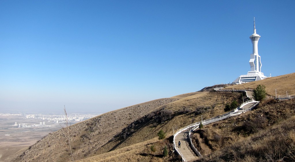
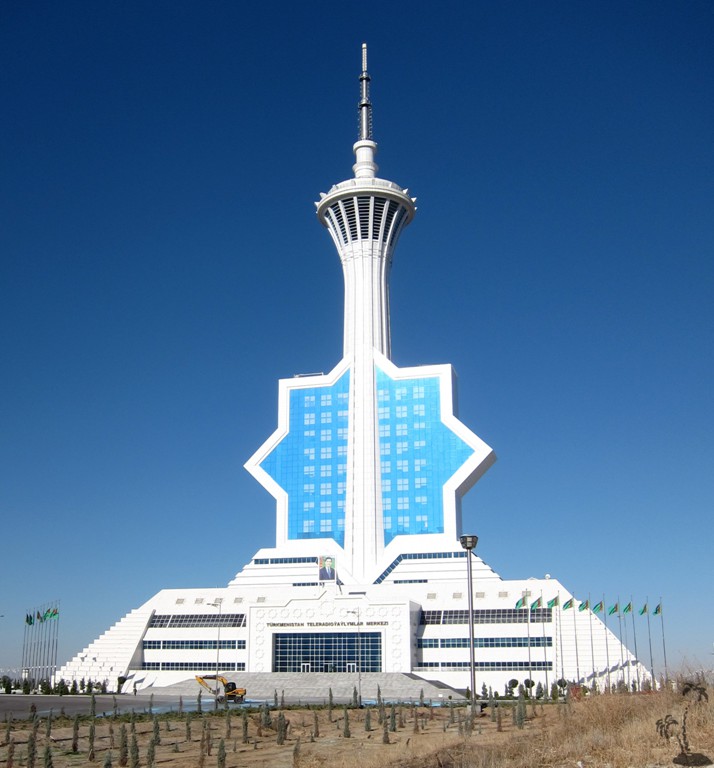
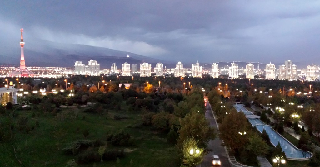
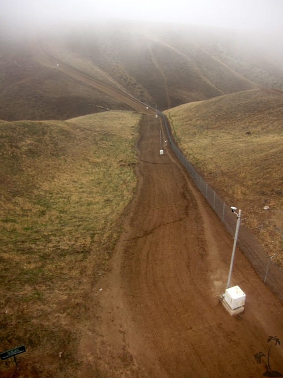
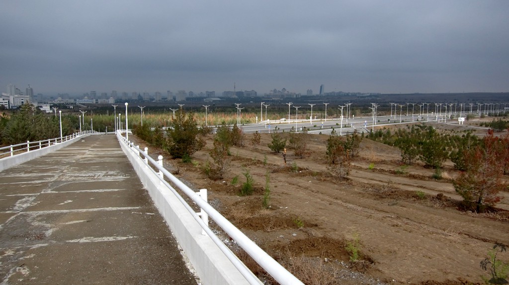
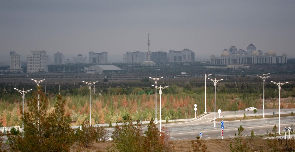
From there, we continued towards the Ashgabat TV station, sitting at 1000 meter altitude. Completed in 2011, with 211 meters it is the highest building in Turkenistan. This second part is less well maintained, and doesn't have golden wildlife on display.
The TV station cannot be visited, at least not by the casual hiker. There is a bus from TV station back to Ashgabat, or hitch a friendly Turkmen, as long as you don't mind to travel without seatbelts.
Beware: this is not a walk in the park, even though the risk of getting lost is minimal. The hike covers about 12.3 kilometers and 1100 meters in elevation gain (and 500 meters in elevation loss).
Note that along the first 7 kilometers of the trail, there are a few alternatives, Following the right fork will be generally easier, while taking the left fork involves more up and down, and is closer to cliffs and views.
| Maximum altitude: | 1007 meter | ||||||||||||||||||||||
| Minimum altitude: | 338 meter | ||||||||||||||||||||||
| Cumulative height: | 1051 meter | ||||||||||||||||||||||
| Cumulative length: | 12.2 kilometer | ||||||||||||||||||||||
Difficulty
| easy, but don't underestimate |
Time:
|
5 hours |
Date of this record |
October 2014 |
Download GPS info: |
Saglyk Yoly 1 |
|
| |
|
|
|
|
|
|
|
|
|
|
|
|
|
|
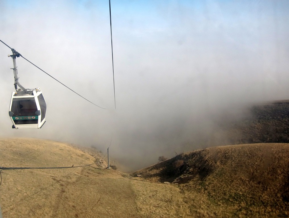
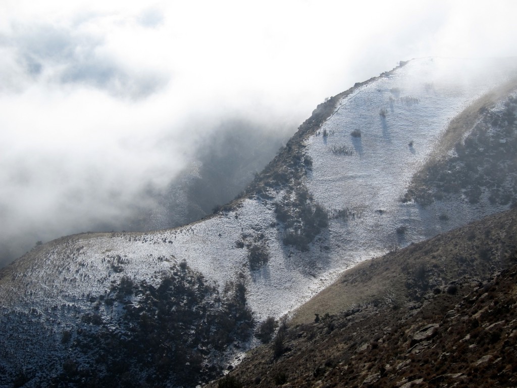
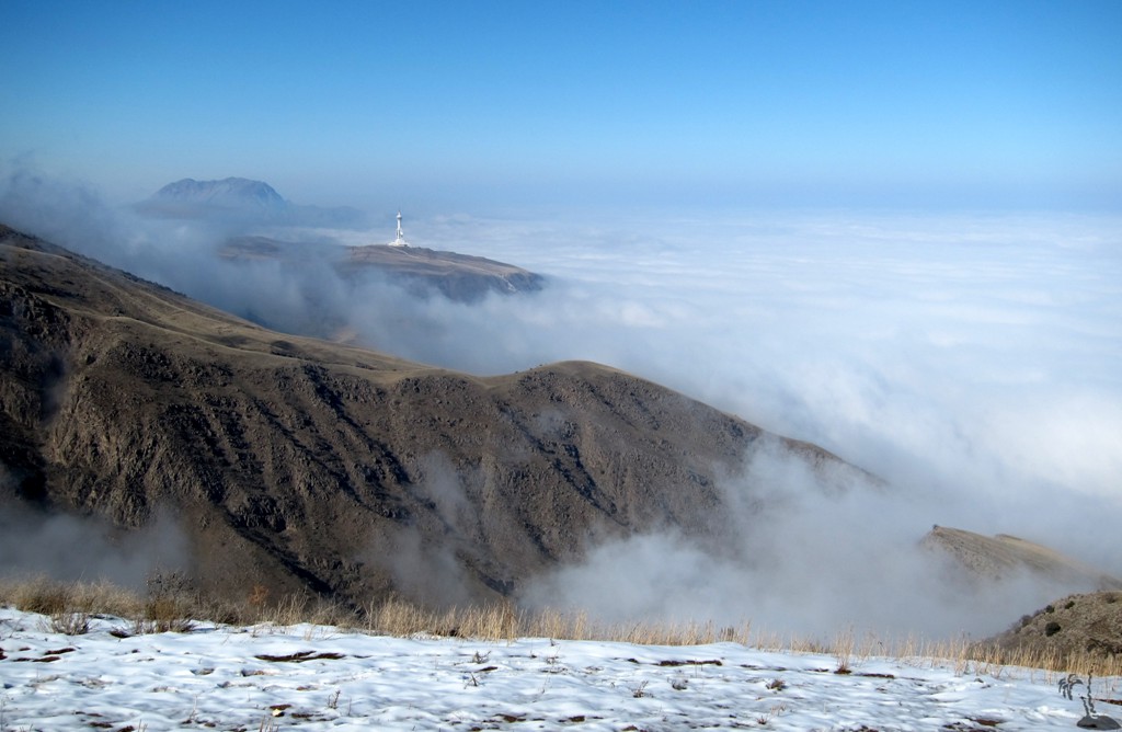
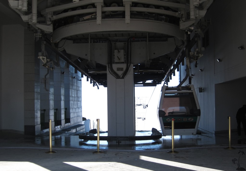
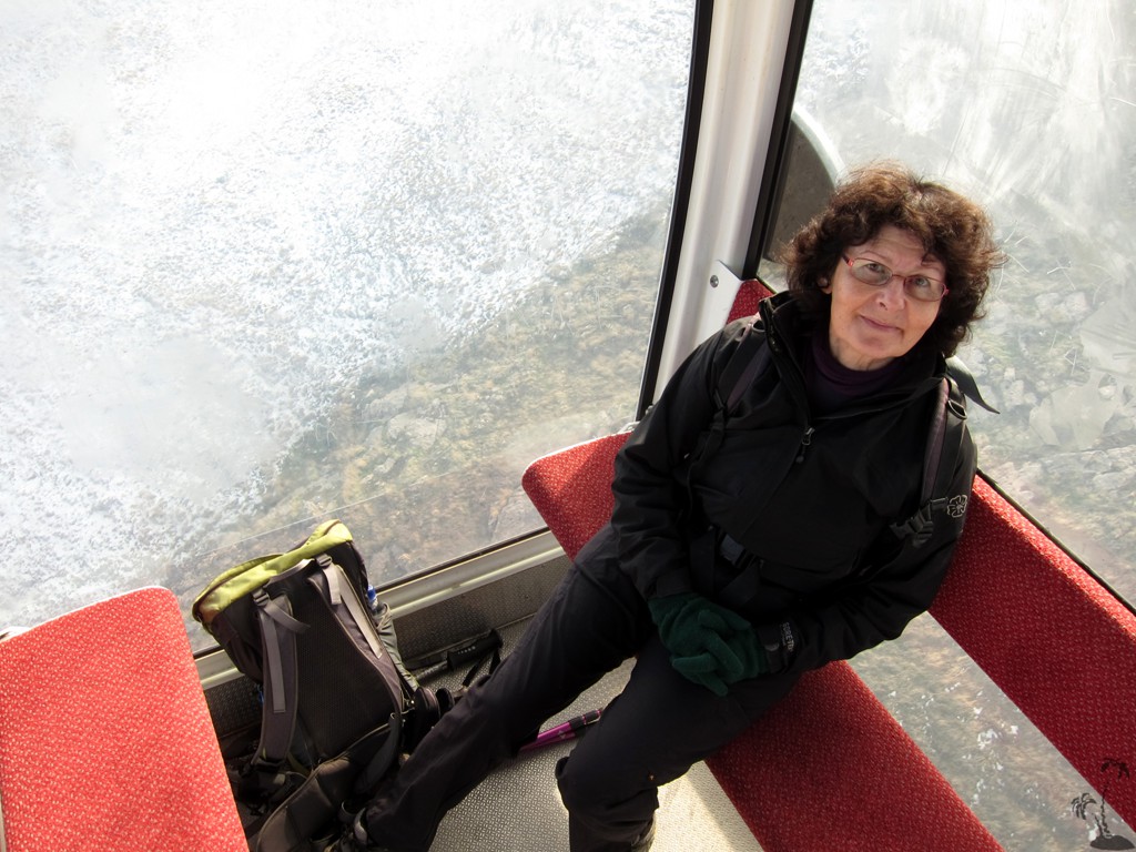
Health Path 2: On a typical misty November day an excursion up to the plateau of the Kopet-Dag Mountains is a rewarding thing to do. Hiking is not permitted in the vicinity of the border to Iran, but there is a cable car that was installed in 2006. We had originally planned to hike from the bottom station to the top station, but were not allowed to do so. So we took the ride instead. It costs the equivalent of 50 cents for citizens and foreigners alike: clearly people are supposed to make use of the cable car like they ride the bus.
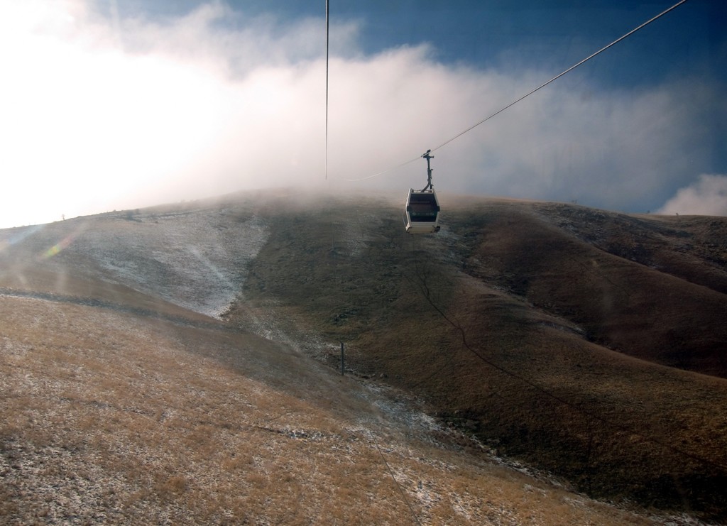
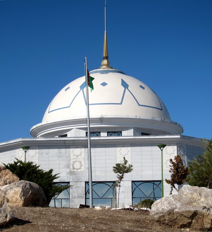
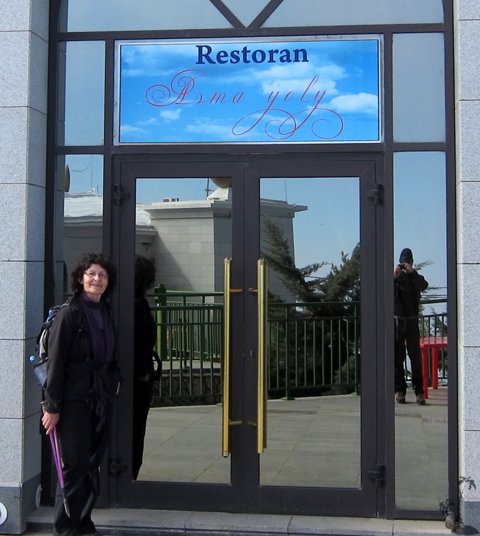
About ten minutes takes the ride of 3,5 km steep uphill and brings the visitor up to an altitude of 1293m. On a clear day the view over Ashgabat must be spectacular, but even on a cloudy day there are moments of sunshine and partial views along the border range. No hiking is allowed from here, but visitors have to stay in the perimeter of the restaurant facility, which was closed due to the off-season.
There may be a delay in descent though, when the top station’s water supply is being replenished. This happens by way of large containers taking all space of a the cable car. Filling and dewatering takes place as the cabins move along the platform.
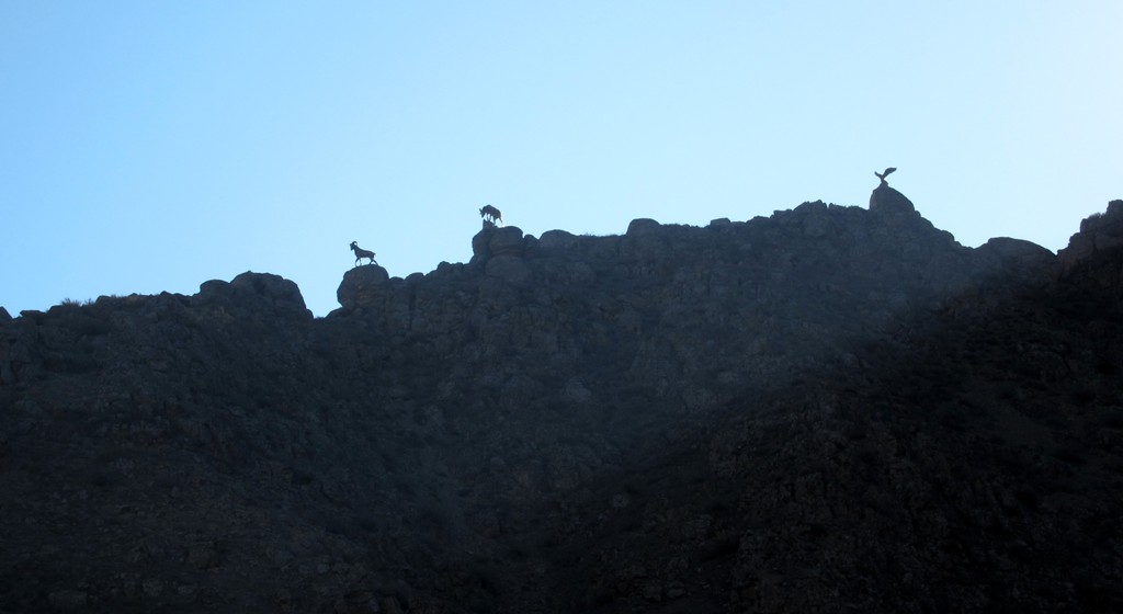
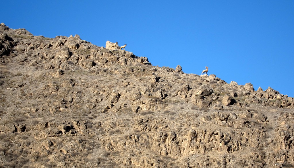
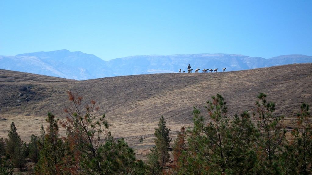
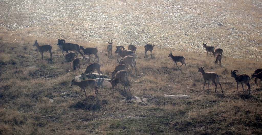
There was a reward for the delay: The spectacular sighting of two herds of grazing Marco Polo sheep. Having seen many kind of sheep in different countries such majestic horns were a novelty to us.
We did our stretch of hiking that day, although this part of the health trail is not well trodden and may need some weeding. Starting in fog again at the basis station we had an easy walk down to the edge of the city, from where we caught a conveniently arriving scheduled bus back to the hotel.
| Maximum altitude: | 1293 meter | ||||||||||||||||||||||
| Minimum altitude: | 517 meter | ||||||||||||||||||||||
| Cumulative height: | 749 meter | ||||||||||||||||||||||
| Cumulative length: | 7.5 kilometer | ||||||||||||||||||||||
Difficulty
| easy |
Time:
|
2 hours for the hike |
Date of this record |
October 2014 |
Download GPS info: |
Saglyk Yoly 2 |
|
| |
|
|
|
|
|
|
|
|
|
|
|
|
|
|
General location and approach: Near Ashgabat, the capital of Turkmenistan
Other Information: Turkmenistan is still very much closed to visitors. For a visa, one needs a letter of invitation. Some travel agencies may be able to arrange this, for certain areas. Some areas of Turkmenistan are closed to visitors. Internet is difficult to get, and facebook and youtube are not accessible from Turkmenistan.
Note that every car in Ashgabat can be taxi, which will cost about two dollars from any to any other location in Ashgabat. Is this sounds cheap, note that petrol can be bought for 25 cents per litre. A taxi to any of the trailheads or ends described here will cost more.


GPS and trailmaps:
The map and
trailinformation is generated by
![]() , based
on GPS information collected from the actual hike. Waypoints
can be downloaded to a GPS device from Wikiloc. If necessary, use
GPSBabel to
convert GPS data to different formats. For more
hike descriptions by Palmtreetreeproduction, browse this
website or visit Wikiloc
and search for "Palmtreeproduction". You may also find
nearby trails from other authors.
, based
on GPS information collected from the actual hike. Waypoints
can be downloaded to a GPS device from Wikiloc. If necessary, use
GPSBabel to
convert GPS data to different formats. For more
hike descriptions by Palmtreetreeproduction, browse this
website or visit Wikiloc
and search for "Palmtreeproduction". You may also find
nearby trails from other authors.
Google Earth: You may also view the trail in 3D by clicking "view in Google Earth" when on Wikiloc. You need to have Google Earth installed on your computer.