PALM TREE PRODUCTIONS
back to Albania site back to hikes and climbs back to Locations and Travel
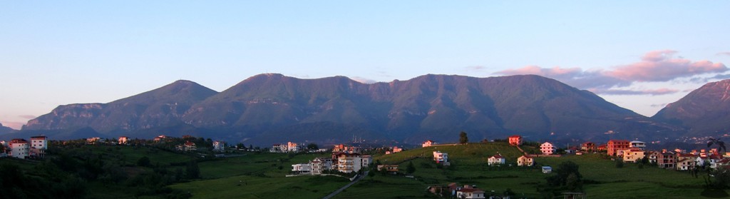
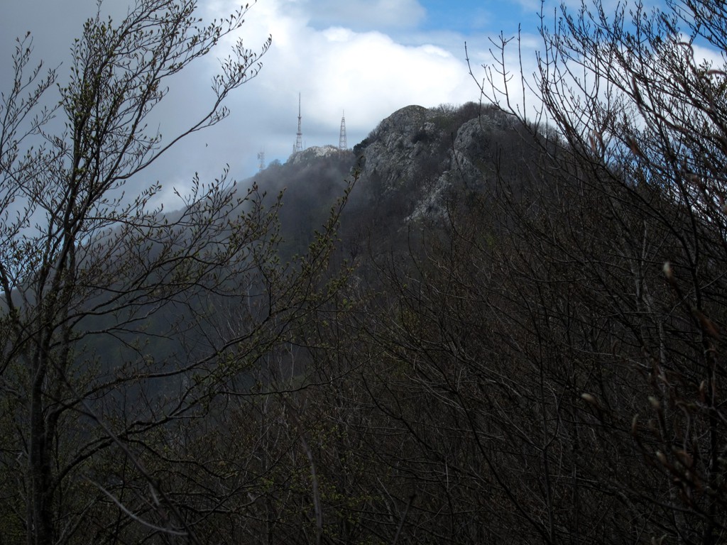
Dajti Crest Revisted![]()
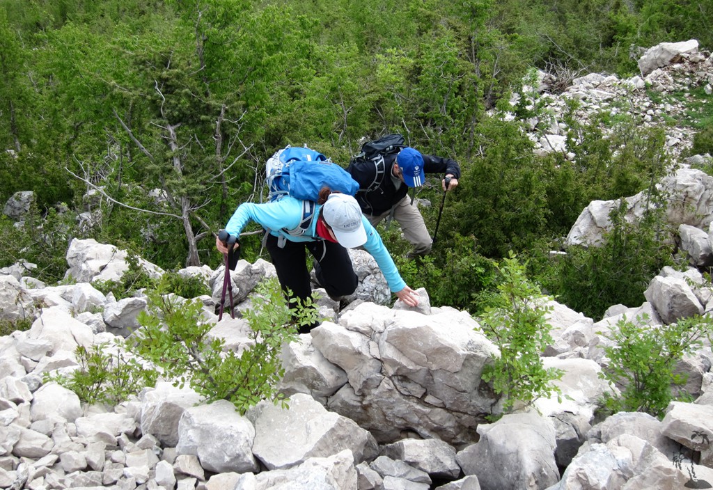
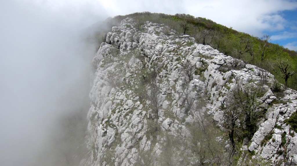
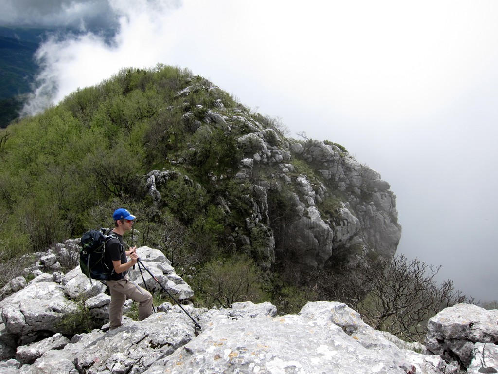
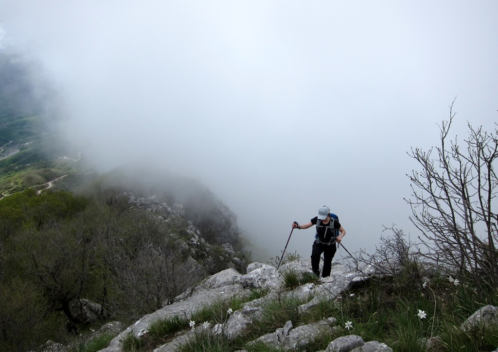
Summary: See also Dajti Crest Trail and Dajti. In May 2014, we went again on the Dajti Crest Trail. The trail markings were slowly fading away, the trail was more overgrown, and the areas destroyed by fire in late 2012 were slowly recovering. Regardless, it remains a prime hike in Tirana. This time we concluded the hike with a direct trail to the (real) summit.
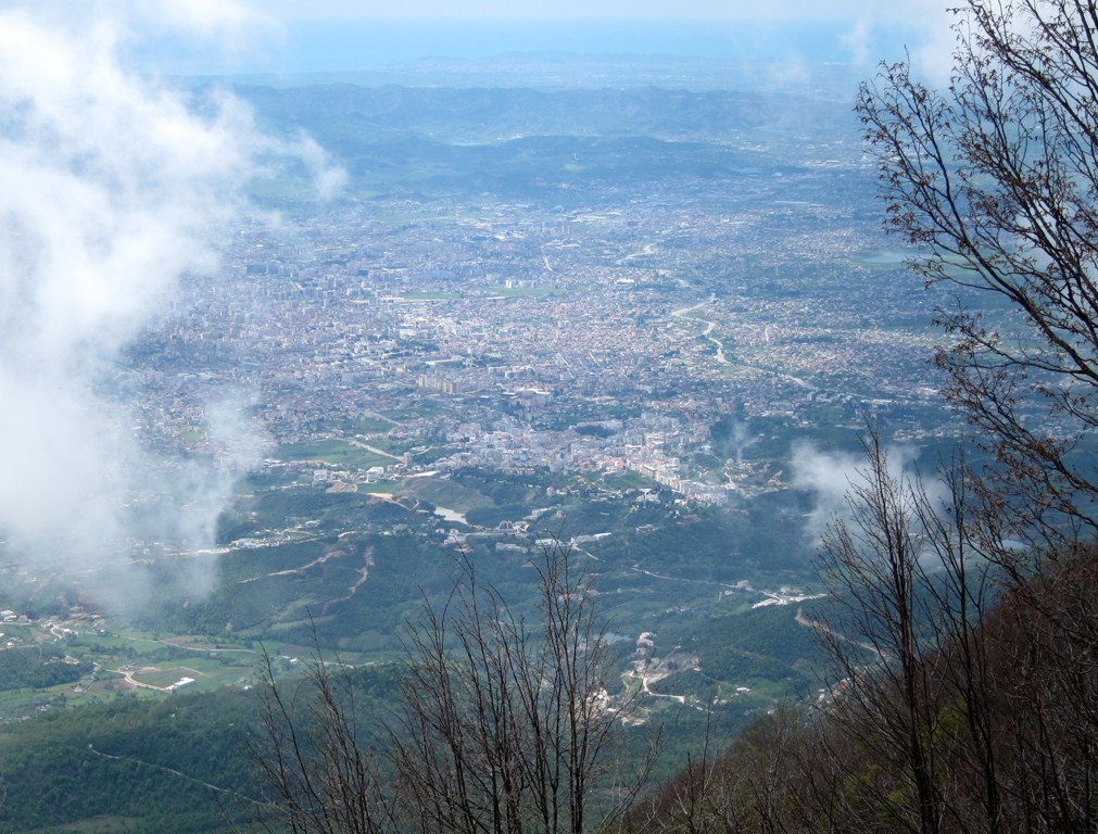
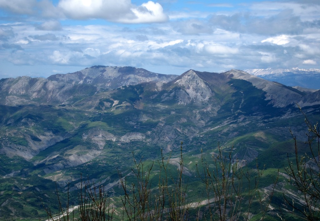
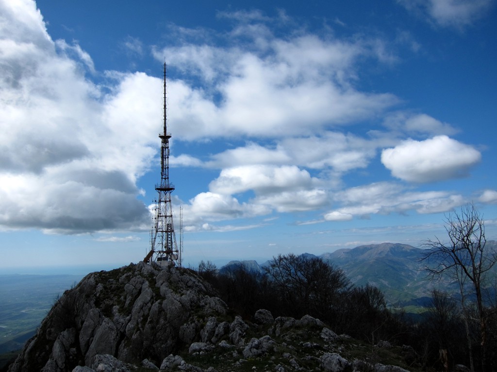
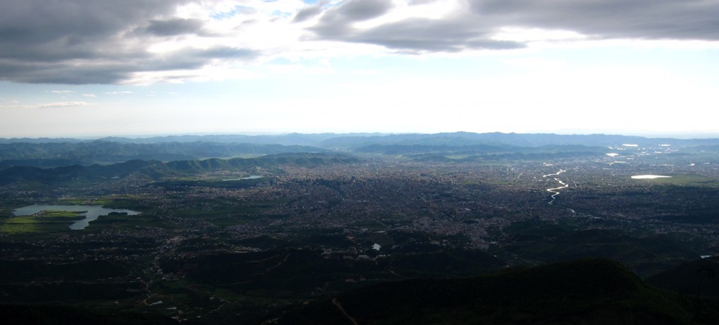
And we had good luck with the views!
| Maximum altitude: | 1599 meter |
| Minimum altitude: | 936 meter |
| Cumulative height: | 800 meter |
| Cumulative length: | 9.25 kilometer |
| Difficulty | moderate |
| Time: | 6.5 hours |
| Date of this record | April 2014 |
| Download GPS info: | Dajti Crest Revisited |
Other Information: See also Dajti Crest Trail and Dajti.
GPS and trailmaps: The map and
trailinformation is generated by
![]() , based
on GPS information collected from the actual hike. Waypoints
can be downloaded to a GPS device from Wikiloc. If necessary, use
GPSBabel to
convert GPS data to different formats. For more
hike descriptions by Palmtreetreeproduction, browse this
website or visit Wikiloc
and search for "Palmtreeproduction". You may also find
nearby trails from other authors.
, based
on GPS information collected from the actual hike. Waypoints
can be downloaded to a GPS device from Wikiloc. If necessary, use
GPSBabel to
convert GPS data to different formats. For more
hike descriptions by Palmtreetreeproduction, browse this
website or visit Wikiloc
and search for "Palmtreeproduction". You may also find
nearby trails from other authors.
Google Earth: You may also view the trail in 3D when viewing it in Google Earth, which you need to have installed on your computer. The 3D perspective allows a good preview of gradients, steepness, possible views and is generally helpful when planning a trip.