
PALM TREE PRODUCTIONS
Albania Hikes, Climbs, Offroading and Interesting Sites
Albania has been terra incognita (for non-Albanians) for visitors, tourists, and even many Albanians! This is now changing, with much infrastructure being created, good ratings by the Lonely Planet and other guidebooks, and many organized travel groups. But signage and maps are still lacking, and the casual visitor - and even resident - may often not know how to find or reach worthwhile places. Without a very good idea on where you are going, it is easy to get lost in Albania!
Here are hikes, climbs, offroading tours and worthwhile locations that we have visited. Many hikes can only be reached after some interesting four-wheel drive. Some interesting hiking locations will also appeal to non-hikers (such as the Pellumba Cave ).
![]()
![]()
![]()
![]()
Hikes and drives are marked with colored symbols according to the level of difficulty. A red hike would be a mountain climb requiring serious previous experience. Most offroad drives do follow a road, though it might be rarely used and in a very bad condition. A red drive indicates that there is at least one spot which may get you seriously stuck.
![]()
![]()
![]()
![]()
For most recent hikes or drives we include google maps and other relevant information. You can download GPS coordinates and trail data to your GPS device by linking to wikiloc.org.
 Hikes, in order of elevation
Hikes, by region
Offroad driving adventures
Other adventures
Cultural or archaeological interest
Other interesting locations
Travelling in Albania
Curiosities
Literature
Hikes, in order of elevation
- Korab (2763 Meter). The highest mountain of Albania sits on the border to Macedonia. The climb from the Albania is a tremendous experience.
- Maja e Popluks (2569 Meter) in the Albanian Alps. We first took a mule up to Gropa e Bukurat, from which we started the more serious hike.
- Gramos (2520 Meter), the highest Mountain in southern Albania, on the border to Greece. A pleasant hike across the meadows with a little excitement on the summit
- Gjallica (2486 Meter) Gjallica towers over Kukes, and dominates the view of anything in this northern town. The climb is very rewarding
- Nemercke from Permet (2485 Meter) - a two day hike to one of the oustanding summits in Albania
- Nemercke with its summit Papingut (2485 Meter) has a dramatic east face, but can be climbed easily from the Zagoria valley
- Cuka Partizan (2416 Meter) - the summit of Tomorri, including how to get there.
- Koritnik (2397 Meter), on the border of Albania and Kosovo, near Kukes. The drive to the trailhead is also a worthwhile undertaking
- Velivar, locally known as Hinoska (2369 Meter) is the highest point of Deshat, the southern part of the ridge leading from Korab to Diber.
- Mali i Ostrovicë (2362 Meter) is remote and has a steep ascent. The approach is via Voskopoje with its old churches, and an interesting offroad excursion to Lekas and Marjam
- Valamares (2350 Meter), in the south of Albania, one of our favorites. A hotel at the trailhead and an interesting approach
- Kërçin (2342 Meter) on the ridge separating Albania and Macedonia, north of Diber. It is a little ower than its neighbor Velivar, but a much higher climb as you have to start low.
- Mali i Thatë (2288 Meter) - or the Dry Mountain - separates Lake Ohrid and Lake Prespa, both of which can be seen from its summit
- Maja e Zeze (2260 Meter) - the highpoint of the jabllanica range, on the border of Albania with Macedonia. More to explore around Stebleve.
- Mali e Dejes (2246 Meter) is the highpoint in Burrel region.
- Shebenik (2225 Meter) gave the cross-border Shebenik-Jabllanice Park its name. Its a long hike.
- Maja e Kulmakës (2177 Meter), next to Tomorri, and one of the big southern Albania mountains
- Mali i Kallabakut (2171 Meter) is on the border of Albania and Kosovo, in the very interesting hinterland of Kukes region
- Cajupi Summit (2145 Meter) near Gjirokaster - certainly one of the southern highlights
- Mali e Kendervices (2120 Meter), one of the "big six" mountains fo Albania, with an interesting approach
- Maja e Kunora e Lurës (2120 Meter) - or the lure of Lura
- The Crown of Lure (2120 Meter) from Kroi Bardhe - an easy alternative to climb the summit of Lure
- Mali e Allamanit (2103 Meter) is well worth an outing, starting at an old mine
- Mali i Kreshtës (2102 Meter) belongs to the Micekut Mountains, as Allamani does. The hike starts in Bulqize and leads into a wilderness, where we saw fresh bear tracks
- Guri i Zi (2071 Meter), Via Egnatia and ancient graves
- Try a diretissima on Maja e Rrunjës (2056 Meter), or perhaps better the eastern ridge. First you have to reach Lukan village...
- An Albanian Ultra - Mali i Çikës (2044 Meter). One of the great hikes of Albania
- Across Dhoksit and Lopës (2022 Meter) to Liqeni Zi
- Maja e Qorres (2018 Meter), near the Llogara Pass
- Mali i Munellës (1996 Meter), the highest mountain in Lezhe region and Mirdite District. Like a molar sticking out from the gums, but in need of a dentist.
- Maja Rrunja e Lures (1990 Meter) is an option for those with a day to spare in the Lure Park
- Pashtrik Mountain (1989 Meter), in Has district, near Kukes
- Maja e Zebe (1987 Meter) is the highpoint of Mali i Shentit, the long ridge that separates the Autobahn to Kukes from the road to the Lure National Park
- Arithit (1986 Meter) and Tolla (1976 Meter) are near Bulquize, and provide a fresh view into the Drin basin and towards Korab mountain
- Mali i Polisit (1973 Meter), the hidden but beautiful mountain near Elbasan
- Mali i Gribes (1967 Meter) and the Mystic Stan - the ideal spring hiking tour
- Maja e Strakovecit (1962 Meter) - A Hike Along the Edge! - with fantastic views over southern Albania
- Mali i Trebeshinës (1912 Meter) - one of the southern giants
- Maja e Gaferit (1896 Meter) - It may easily take longer to get there than to climb to the summit - but the circumnavigation of Gafer is not to be laughed about!
- Shirakë (1876 Meter) - we called it Bald Head until we climbed it.
- Kalimash Mountain - Maja e Runës (1863) sits on top of the Kalimash tunnel on the Tirana - Kukes highway.
- Guri i Nuses (1837 Meter) has one of the most dramatic rock faces in Albania outside the northern alps
- Mali me Gropa (1829 meter), the "mountain with holes", behind Dajti mountain
- Maja e Bukanikut (1821), and the drive down to the Holta Gorge
- Mali i Gurit (1821 Meter), near Fushë Studën - on a clear autumn day with beautful views to everything
- Mali i Snojt (1812 Meter), with a long approach to a seemingly nearby mountain
- Mourgana (1806 Meter) on the border to Greece - the southernmost big mountain of Albania
- Mali i Shëndëllisë (1803 Meter), near Tepelene - also excellent in winter conditions
- Mali i Komjanit (1790 Meter) in the Valamares/Grabove area, where there is so much to do. The hike starts from Teqe Dushkut.
- Mali i Stugares (1771 Meter) along the border to Greece is a hidden treasure. To reach the trailhead is an adventure in itself.
- Mali i Bureto (1759 Meter) near Gjirokaster has a very steep west face, which becomes a little difficult after the first snow.
- Maja e Muleqithit (1729 Meter) is the higher of the two summits of Mali i Cukalit east of Shkodra. There are two summits which can be combined with an interesting 4WD route and camping at Fusha e Liqenit.
- Maja e Velecikut (1725 Meter) near Razem and Shkodra
- Mali i Skenderbeut (1721 Meter) is easy, has fantastic views and is best combined with a 4WD trip from Kruja across Qafe Shtame to Burrel
- Maja e Cukalit (1717 Meter) is the lower of the two summits of Mali i Cukalit east of Shkodra. There are two summits which can be combined with an interesting 4WD route and camping at Fusha e Liqenit.
- Mali i Sukes (1717 Meter), near Burrel
- Mali i Papatit (1613 Meter), between Zall and Guri Bardhë, in the hinterland between Tirana and Klos
- Dajti Mountain (1611 Meter), which can be combined with Maja e Tujanit (1531 Meter). Ignore the cable car and hike from the foot of Dajti
- Dajti Crest Revisted (1611) - a repeat of our Dajti Crest trail this time with the antenna-summit.
- Rumija Mountain (1589 Meter) is actually in Montenegro, but can climbed very nicely from a base in Albania
- Dajti Crest Trail (1568 Meter), perhaps the best way to climb and travers Dajti Mountain
- Guri Gjon (1436 Meter) is a natural monument near Kurbnesh. There is difficult and a moderate way to the top of the cliff.
- Mali i Fagut (1426 Meter), on a February day, from the hamlet of Kllojkë.
- Mali i Korres (1410 Meter) on the border between Tirana and Elbasan - but so far better to reach from Elbasan
- Priske Mountain (1361 Meter), much neglected, close to Tirana, but needs some stamina for a solid bushwhack
- Mali i Ostrovices (1358 Meter), a little obscur, offers nice walking through forest and an open ridge, with great views into the little know area between Elbasan and Bize.
- Gomnit Mountain (1273 Meter), a little neglected, and slightly more difficult than its neigbors (Kruja and Brar mountains)
- Shëne Prende and Maja e Hutit (1248 Meter), near the confluence of the Mat and Fan. Maja e Hutit is the northern end of the mighty Skenderbeut range
- Brar Mountain (Main Summit, 1219 Meter), a wonderful mountain nearby Tirana, without the traffic of Dajti
- Round about and to the top of Mali i Shipragut (1193 Meter) - near Berat
- North Summit of Brar (1190 Meter) from Priske e Vogel
- Brar Mountain (North Summit, 1190 Meter), and loop back via Arber Road
- Veles Traverse (1172 Meter) - Three time lucky - a racy alternative for climbing Veles
- Velës main summit (1168 Meter) from the Rrëja e Velës
- Kruja Mountain (1134 Meter). Everybody visits Kruja, but few climb the face of the mountain to visit the Bektashi temple on the top of mountain
- Mali i Veles - Weatherstation (1130 Meter), near Lezha. We climbed it on its western side, to the secondary summit with its chapel and weatherstation
- The Dajti Mountain Trail (1117 Meter) explores the rear side of Dajti Mountain
- Kodra and Kalasës (1089 Meter), the two summits above Krrabe. An easy hike with some bushwhacking, and simultaneous views to Tirana and Elbasan
- Dajti Plateau (1055 Meter) from Tujan, and back via Shermini
- Dead End Dajti (965 Meter), an -unsuccessful- attempt to reach the Dajti Plateau through the north face
- Maja e Rakshanit (930 Meter) is north of Kruja, has stunning views onto Kruja Mountain, and makes a river disappear
- A Pot of Gold... is not the reason to go to Rosavere, but it offers fine hiking (highest point of this loop is 904 Meter)
- Follow the Priske Ridge near Përcëllesh (886 Meter)
- Milë Mountain (823 Meter) near Butrint, allows to connect archeological wonders with some exercise.
- Zeza Canyon Alpine Loop (810 Meter)
- Gracen (804 Meter) offers an interesting but long hike left and right of the Tirana Highway. It is like hiking two mountains in reverse...
- Rosavere is a village mostly accessible by foot. The highest point of the loop hike is 796 Meter
- A hike of Mal Milot - near Milot - may get you to two summits: Maja e Suksit (669 Meter) and the summit proper (785 Meter)
- Grunas Waterfall in Thethi (782 Meter). And as you are at it, include a stroll to Thethi's most important sights.
- Petrela Ridge (764 Meter). The ridge stretching south of Petrela castle provides many hours of hiking with excellent views.
- Mail i Gallushit (747 Meter), not too far from Tirana, but still remote, with good views towarsd the Adriatic
- Two for One can be had when climbing ShenMarie (725 Meter) and Kodra e Luncit (745 Meter) near Balldushk ... provided you are ready to ford some rivers
- Priske Mountain and Erzen Gorge (732 Meter). A hike close to Tirana, to a small summit with good views and into the canyon of the Erzen River
- Kodra e Xhanivet (708 Meter) on the border between Tirana and Elbasan regions. A short but rewarding hike with a difficult 4WD access
- Vrap - three mountains (671 Meter) and old graveyards
- Via Egnatia from Ura e Kamares (650 Meter) - a half day's outing with a piece of the Egnatia
- Streamhopping and Bushwhacking near Krrabë (620 Meter)
- Mali i Hajmelt (612 Meter), between Lezha and Shkodra
- Illyrian Stones and a Lofty Summit (592 Meter) - the secret treasures of Petrelë
- Kalofsh Mirë on Korbit Hill (553 Meter) - a spring energizer
- Wolves, Snakes and Hospitality on Mali i Rencit (546 Meter)
- Thartor village and mountain (522 Meter) provide new perspectives. Near Peqin and Rrogozhina.
- Mali i Palleshit (518 Meter) - another erosion ramble, near Baldushk
- Zaranika Ramble (516 Meter) - from the valley of Zaranika to the hill of Përsqop - through a wild landscape of erosion and delightful pine forests
- Pellumba Cave (479 Meter). The attraction is not the altitude, but the cave!
- Fjolla Lake and Dorez Castle (474 Meter). A lake, a castle, nice trails and excellent views.
- Beautiful Lake Alltata and Mal Zajs (471 Meter)
- Tujan Village to Dajti village, above Tirana River Gorge (456 Meter)
- Sotirë Water Falls (418 Meter) near Gramsh, at the foot of Tomorri Mountain.
- Visit Lake Rrove and hike the area (396 Meter)
- Pay a visit to the ruins of Varoshi Castle (377 Meter)
- Tirana to Petrela (342 Meter). Why not walking, instead of driving, from Tirana to Petrela Castle for lunch?
- Explore Zeza Canyon (332 Meter), close to Tirana, with its ancient path and bridges.
- Sub-urban Jungle in Tirana (277 Meter)
Hikes, by region
Note that especially in Albania, distance is relative. From Tirana, you might be faster in Kukes to climb Gjallica, than in nearby Bize to climb Mali i Snojt!
Hikes: Greater Tirana, Central (south of the Mat valley and north of the Shkumbin)
- Maja e Zeze (2260 Meter) - the highpoint of the jabllanica range, on the border of Albania with Macedonia. More to explore around Stebleve.
- Shebenik (2225 Meter) gave the cross-border Shebenik-Jabllanice Park its name. Its a long hike.
- Across Dhoksit and Lopës (2022 Meter) to Liqeni Zi
- Mali me Gropa (1829 meter), the "mountain with holes", behind Dajti mountain
- Mali i Gurit (1821 Meter), near Fushë Studën - on a clear autumn day with beautful views to everything
- Mali i Snojt (1812 Meter), with a long approach to a seemingly nearby mountain
- Mali i Sukes (1717 Meter), near Burrel
- Mali i Skenderbeut (1721 Meter) is easy, has fantastic views and is best combined with a 4WD trip from Kruja across Qafe Shtame to Burrel
- Mali i Papatit (1613 Meter), between Zall and Guri Bardhë, in the hinterland between Tirana and Klos
- Dajti Mountain (1611 Meter), which can be combined with Maja e Tujanit (1531 Meter). Ignore the cable car and hike from the foot of Dajti!
- Dajti Crest Revisted (1611) - a repeat of our Dajti Crest trail this time with the antenna-summit.
- Rumija Mountain (1589 Meter) is actually in Montenegro, but can climbed very nicely from a base in Albania
- Dajti Crest Trail (1568 Meter), perhaps the best way to climb and travers Dajti Mountain
- Mali i Fagut (1426 Meter), on a February day, from the hamlet of Kllojkë.
- Mali i Korres (1410 Meter) on the border between Tirana and Elbasan - but so far better to reach from Elbasan
- Priske Mountain (1361 Meter), much neglected, close to Tirana, but needs some stamina for a solid bushwhack
- Mali i Ostrovices (1358 Meter), a little obscur, offers nice walking through forest and an open ridge, with great views into the little know area between Elbasan and Bize.
- Gomnit Mountain (1273 Meter), a little neglected, and slightly more difficult than its neigbors (Kruja and Brar mountains)
- Shëne Prende and Maja e Hutit (1248 Meter), near the confluence of the Mat and Fan. Maja e Hutit is the northern end of the mighty Skenderbeut range
- Brar Mountain (Main Summit, 1219 Meter), a wonderful mountain nearby Tirana, without the traffic of Dajti
- North Summit of Brar (1190 Meter) from Priske e Vogel
- Brar Mountain (North Summit, 1190 Meter), and loop back via Arber Road
- Kruja Mountain (1134 Meter). Everybody visits Kruja, but few climb the face of the mountain to visit the Bektashi temple on the top of mountain
- The Dajti Mountain Trail (1117 Meter) explores the rear side of Dajti Mountain
- Kodra and Kalasës (1089 Meter), the two summits above Krrabe. An easy hike with some bushwhacking, and simultaneous views to Tirana and Elbasan
- Dajti Plateau (1055 Meter) from Tujan, and back via Shermini
- Dead End Dajti (965 Meter), an -unsuccessful- attempt to reach the Dajti Plateau through the north face
- Maja e Rakshanit (930 Meter) is north of Kruja, has stunning views onto Kruja Mountain, and makes a river disappear
- A Pot of Gold... is not the reason to go to Rosavere, but it offers fine hiking (highest point of this loop is 904 Meter)
- Follow the Priske Ridge near Përcëllesh (886 Meter)
- Zeza Canyon Alpine Loop (810 Meter)
- Gracen (804 Meter) offers an interesting but long hike left and right of the Tirana Highway. It is like hiking two mountains in reverse...
- Rosavere is a village mostly accessible by foot. The highest point of the loop hike is 796 Meter
- A hike of Mal Milot - near Milot - may get you to two summits: Maja e Suksit (669 Meter) and the summit proper (785 Meter)
- Petrela Ridge (764 Meter). The ridge stretching south of Petrela castle provides many hours of hiking with excellent views.
- Mail i Gallushit (747 Meter), not too far from Tirana, but still remote, with good views towarsd the Adriatic
- Two for One can be had when climbing ShenMarie (725 Meter) and Kodra e Luncit (745 Meter) near Balldushk ... provided you are ready to ford some rivers
- Priske Mountain and Erzen Gorge (732 Meter). A hike close to Tirana, to a small summit with good views and into the canyon of the Erzen River
- Kodra e Xhanivet (708 Meter) on the border between Tirana and Elbasan regions. A short but rewarding hike with a difficult 4WD access
- Vrap - three mountains (671 Meter) and old graveyards
- Streamhopping and Bushwhacking near Krrabë (620 Meter)
- Illyrian Stones and a Lofty Summit (592 Meter) - the secret treasures of Petrelë
- Kalofsh Mirë on Korbit Hill (553 Meter) - a spring energizer
- Thartor village and mountain (522 Meter) provide new perspectives. Near Peqin and Rrogozhina.
- Mali i Palleshit (518 Meter) - another erosion ramble, near Baldushk
- Zaranika Ramble (516 Meter) - from the valley of Zaranika to the hill of Përsqop - through a wild landscape of erosion and delightful pine forests
- Pellumba Cave (479 Meter). The attraction is not the altitude, but the cave!
- Fjolla Lake and Dorez Castle (474 Meter). A lake, a castle, nice trails and excellent views.
- Beautiful Lake Alltata and Mal Zajs (471 Meter)
- Tujan Village to Dajti village, above Tirana River Gorge (456 Meter)
- Visit Lake Rrove and hike the area (396 Meter)
- Pay a visit to the ruins of Varoshi Castle (377 Meter)
- Tirana to Petrela (342 Meter). Why not walking, instead of driving, from Tirana to Petrela Castle for lunch?
- Explore Zeza Canyon (332 Meter), close to Tirana, with its ancient path and bridges.
- Sub-urban Jungle in Tirana (277 Meter)
Hikes: North and Northeast
- Korab (2763 Meter). The highest mountain of Albania sits on the border to Macedonia. The climb from the Albania is a tremendous experience.
- Maja e Popluks (2569 Meter) in the Albanian Alps. We first took a mule up to Gropa e Buruat, from which we started the more serious hike.
- Gjallica (2486 Meter) Gjallica towers over Kukes, and dominates the view of anything in this northern town. The climb is very rewarding.
- Koritnik (2397 Meter), on the border of Albania and Kosovo, near Kukes. The drive to the trailhead is also a worthwhile undertaking.
- Velivar, locally known as Hinoska (2369 Meter) is the highest point of Deshat, the southern part of the ridge leading from Korab to Diber.
- Kërçin (2342 Meter) on the ridge separating Albania and Macedonia, north of Diber. It is a little ower than its neighbor Velivar, but a much higher climb as you have to start low.
- Mali e Dejes (2246 Meter) is the highpoint in Burrel region.
- Mali i Kallabakut (2171 Meter) is on the border of Albania and Kosovo, in the very interesting hinterland of Kukes region
- Maja e Kunora e Lurës (2120 Meter) - or the lure of Lura.
- The Crown of Lure (2120 Meter) from Kroi Bardhe - an easy alternative to climb the summit of Lure
- Mali e Allamanit (2103 Meter) is well worth an outing, starting at an old mine.
- Mali i Kreshtës (2102 Meter) belongs to the Micekut Mountains, as Allamani does. The hike starts in Bulqize and leads into a wilderness, where we saw fresh bear tracks
- Try a diretissima on Maja e Rrunjës (2056 Meter), or perhaps better the eastern ridge. First you have to reach Lukan village...
- Mali i Munellës (1996 Meter), the highest mountain in Lezhe region and Mirdite District. Like a molar sticking out from the gums, but in need of a dentist.
- Maja Rrunja e Lures (1990 Meter) is an option for those with a day to spare in the Lure Park
- Pashtrik Mountain (1989 meter), in Has district, near Kukes
- Maja e Zebe (1987 Meter) is the highpoint of Mali i Shentit, the long ridge that separates the Autobahn to Kukes from the road to the Lure National Park.
- Arithit (1986 Meter) and Tolla (1976 Meter) are near Bulquize, and provide a fresh view into the Drin basin and towards Korab mountain
- Kalimash Mountain - Maja e Runës (1863) sits on top of the Kalimash tunnel on the Tirana - Kukes highway.
- Guri i Nuses (1837 Meter) has one of the most dramatic rock faces in Albania outside the northern alps
- Maja e Muleqithit (1729 Meter) is the higher of the two summits of Mali i Cukalit east of Shkodra. There are two summits which can be combined with an interesting 4WD route and camping at Fusha e Liqenit.
- Maja e Velecikut (1725 Meter) near Razem ans Shkodra
- Maja e Cukalit (1717 Meter) is the lower of the two summits of Mali i Cukalit east of Shkodra. There are two summits which can be combined with an interesting 4WD route and camping at Fusha e Liqenit.
- Rumija Mountain (1589) is actually in Montenegro, but can climbed very nicely from a base in Albania
- Guri Gjon (1436 Meter) is a natural monument near Kurbnesh. There is difficult and a moderate way to the top of the cliff.
- Veles Traverse (1172 Meter) - Three time lucky - a racy alternative for climbing Veles
- Velës main summit (1168 Meter) from the Rrëja e Velës
- Mali i Veles - Weatherstation (1130 Meter), near Lezha. We climbed it on its western side, to the secondary summit with its chapel and weatherstation
- Grunas Waterfall in Thethi (782 Meter). And as you are at it, include a stroll to Thethi's most important sights
- Mali i Hajmelt (612 Meter), between Lezha and Shkodra
- Wolves, Snakes and Hospitality on Mali i Rencit (546 Meter)
Hikes: South
- Gramos (2520 Meter), the highest Mountain in southern Albania, on the border to Greece. A pleasant hike across the meadows with a little excitement on the summit
- Nemercke from Permet (2485 Meter) - a two day hike to one of the oustanding summits in Albania
- Nemercke with its summit Papingut (2485 Meter) has a dramatic east face, but can be climbed easily from the Zagoria valley
- Cuka Partizan (2416 Meter) - the summit of Tomorri, including how to get there.
- Mali i Ostrovicë (2362 Meter) is remote and has a steep ascent. The approach is via Voskopoje with its old churches, and an interesting offroad excursion to Lekas and Marjam
- Valamares (2350 Meter), in the south of Albania, one of our favorites. A hotel at the trailhead and an interesting approach
- Mali i Thatë (2288 Meter) - or the Dry Mountain - separates Lake Ohrid and Lake Prespa, both of which can be seen from its summit
- Maja e Kulmakës (2177 Meter), next to Tomorri, and one of the big southern Albania mountains
- Cajupi Summit (2145 Meter) near Gjirokaster - certainly one of the southern highlights
- Mali e Kendervices (2120 Meter), one of the "big six" mountains fo Albania, with an interesting approach
- Guri i Zi (2071 Meter), Via Egnatia and ancient graves
- An Albanian Ultra - Mali i Çikës (2044 Meter). One of the great hikes of Albania
- Maja e Qorres (2018 Meter), near the Llogara Pass
- Mali i Polisit (1973 Meter), the hidden but beautiful mountain near Elbasan
- Mali i Gribes (1967 Meter) and the Mystic Stan - the ideal spring hiking tour
- Maja e Strakovecit (1962 Meter) - A Hike Along the Edge! - with fantastic views over southern Albania
- Mali i Trebeshinës (1912 Meter) - one of the southern giants
- Maja e Gaferit (1896 Meter) - It may easily take longer to get there than to climb to the summit - but the circumnavigation of Gafer is not to be laughed about!
- Shirakë (1876 Meter) - we called it Bald Head until we climbed it.
- Maja e Bukanikut (1821), and the drive down to the Holta Gorge
- Mourgana (1806 Meter) on the border to Greece - the southernmost big mountain of Albania
- Mali i Shëndëllisë (1803 Meter), near Tepelene - also excellent in winter conditions
- Mali i Komjanit (1790 Meter) in the Valamares/Grabove area, where there is so much to do. The hike starts from Teqe Dushkut.
- Mali i Stugares (1771 Meter) along the border to Greece is a hidden treasure. To reach the trailhead is an adventure in itself.
- Mali i Bureto (1759 Meter) near Gjirokaster has a very steep west face, which becomes a little difficult after the first snow
- Round about and to the top of Mali i Shipragut (1193 Meter) - near Berat
- Milë Mountain (823 Meter) near Butrint, allows to connect archeological wonders with some exercise.
- Via Egnatia from Ura e Kamares (650 Meter) - a half day's outing with a piece of the Egnatia
- Sotirë Water Falls (418 Meter) near Gramsh, at the foot of Tomorri Mountain.
Offroad driving adventures
- Top of Albania (Tomorri) - the highest point in Albania you can reach by car, with a loop to Gjerbes commune
- The Kuç Connection - all three parts. From west to east where mountains and valleys go north to south.... Fun in the River Bed...
- The Notorius Frasher Loop - From Lengarice to Frasher and Bredhi i Hotove National Park
- The Zagoria Loop - the hidden valley between Gjriokaster and Permet
- Dajti Mountain to Klos. Does this road still exist? This road is one of the most frequented searched by offroaders!
- Tirana - Zall - Guri Bardhe - Klos. Take the fabled Arber Road to Guri Bardhë, before the construction companies move in. Though it may take a while....
- The Zhllima Connection - a short invigorating drive near Tirana, of which 2 kilometers are through the bed of the Zhllima River.
- Martanesh - Journey Through the Interior
- The drive across Qafe Shtame starts in Kruja and ends in Burrel. You may pause and climb Mali i Skenderbeut along the way
- If you don't want to drive to Burrel, but still travel parts of the Qafe Shtame road, start at the Bovilla Lake and continue behind Gomnit Mountain. When reaching the Qafe Shtame road, turn left for Kruja.
- Why not trying the cobbled roads of Çermenikë?
- Peshkopi to Librazhd: Along the black Drini and the border wityh Macedonia.
- or try the reverse: From Librazhd to Peshkopi, 2 years later, on the fast track
- Along the Black Drin - an Albanian Classic
- Driving across Mali i Munellës (1996 Meter), from Rreps to Fushe Arrëz, is an almost a perfect light offroad adventure
- The road from Rreshen to Vau-Dejes, via Bukmirë, Kalivaç, Vig and Mnelë is an interesting and not so difficult outing.
- Or try the Ungrej Variant - an alternative to the Bukmirë - Mnelë drive.
- The drive across Mali i Shentit, from Thirrë to Kukes, is not as easy as it looks!
- Mali i Kallabakut and Shishtavec are on the border of Albania and Kosovo, in the very interesting hinterland of Kukes region
- Cross Kalimash mountain, instead of driving through tunnel - but don't think this is a quick excursion...
- The approach to Guri i Nuses, which has one of the most dramatic rock faces in Albania outside the northern alps, from Rreps and down to Klos is a very worthy excursion for the off road enthusiast. On the Guri i Nuses page we have the two more difficult trails to the Lajthizë plateau. We also have the easiest trail (from Reps) and the longest (from Reshen) to Lajthizë.
- The lure of Lura - roundabout Lure and Mali i Dejes
- When travelling to Lure, an excursion to Kroi Bardhe - the White Spring - could be considered
- Drive from Kurdari to an old mine on Allamani mountain (and perhaps hike up Allamani mountain)
- From Bukanikut down to the Holta Gorge
- An extension of the Bukanikut trip is to Shirakë trailhead, with a possible but difficult extension to Porocan.
- It may easily take longer to get to Gafer than to climb to its namesake summit.
- Try a visit to Teqe Dushkut, Lake Dushkut, and the scenic Split Rock near Grabove.
- Round about and to the top of Mali i Shipragut (1193 Meter) - near Berat
- Churches of Ardenica, Libofshe and Shen Kosmas - and a little offroad drive
- Byllis has been one of the largest ancinet town in souther Illyria - and can now also be accessed from the new Fier - Gjirokaster highway. For the road via Klos, a 4WD is recommended
- From Berat to Këlcyra - not exactly a highway
- From Gramsh to Berat via Tomorri, certainly not a shortcut, and certainly for the adventurous
- Permet to the Osumi Canyon and Corovode: the road that doesn't exist
- Even if you don't climb Mali i Ostrovicë, the drive from Voskopje to the villages of Lekas, Marjam or Gjonbabas are a worthwhile excursion. And if you haven't done it before, spend some time in Voskopje to visit the churches.
- From Tepelene to Vlora, on a shortcut.... high above the Vjosa Valley, with nice views towards Kendervices Mountain
- From Vlora to Kuç, Çorraj and Borsh - backcountry to the Ionian Coast.
- The road from Sarande to Kakavije, via the village of Leshnice along the border to Greece is for connoisseurs. It also leads to the trail head for climmbing Stugares.
- Three 4WD tracks west of Lake Ohrid.
- Via Egnatia, Ancient Graves and Guri i Zi
- Maja e Zeze is the highpoint of the Jabllanica range, on the border of Albania with Macedonia, but there is more to explore around Stebleve and the National Park.
- Even if you don't intend to climb Gjallica mountain, the drive to the summer medows is nice and you may decide to spend the night.
- Cruise Koritnik Mountain, as high as you wish, but remember that turning your SUV in a tight spot on a slope may not be easy!
- Bored with the tunnel? Drive across Kalimash Mountain, from Thirrë to the east end of the tunnel or vice versa.
- Getting bored in Razem? Bash you 4WD car along a mountain road to an old cave on Maja e Velecikut.
- And if you happen to be in Shkodra, Bar or environs, why not driving up Rumija Mountain (at least to the trailhead)?
- Or try the route to Fusha e Ligenit on Mali i Culaklit, which also gives you the opportunity to enjoy glorious views, stretch your legs and eat wild strawberries.
- A backroad trail from Petrela to Elbasan, west of the main asphalt road connecting Petrela and Elbasan
- From Paulesh to Baldushk is the Petrela-Elbasan trail in reverse, with some added spice and difficulty.
- Illyrian Stones and a Lofty Summit (592 Meter) - the secret treasures of Petrelë
- Vrap - three mountains (671 Meter) and old graveyards
- Kepi i Rodonit (204 meter) - not much 4-wheeling, but a very nice excursion from Tirana. A cape with steep cliffs, an ancient church and the remains of a castle
- The old road from Elbasan to Gramsh is a nice alternative to the busy main way from Elbasan to Gramsh - or vice versa.
- For those who have seen it all - Belsh Lakes
- An excursion to two villages in the Kardhiq area: Fushe Bardhe and Zhulat
Other adventures
- Rafting the Osumi Canyon. Of course, you need to hire an outfitter, such as Outdoor Albania for a raft, some paddles and instructions
- Explore Pellumba Cave. Bring a flashlight and some snacks - the cave is 380 Meter long.
- Take the ferryboat across the world-famous Lake Komani, which many compare to a travel through a Norwegian Fjord or the Magellan Straits! The lake is narrow and twisting with sheer cliffs dropping right down into the water. Dramatic waterfalls tumble down the cliffs into the lake and from time to time terraced fields and tiny villages cling hillsides.
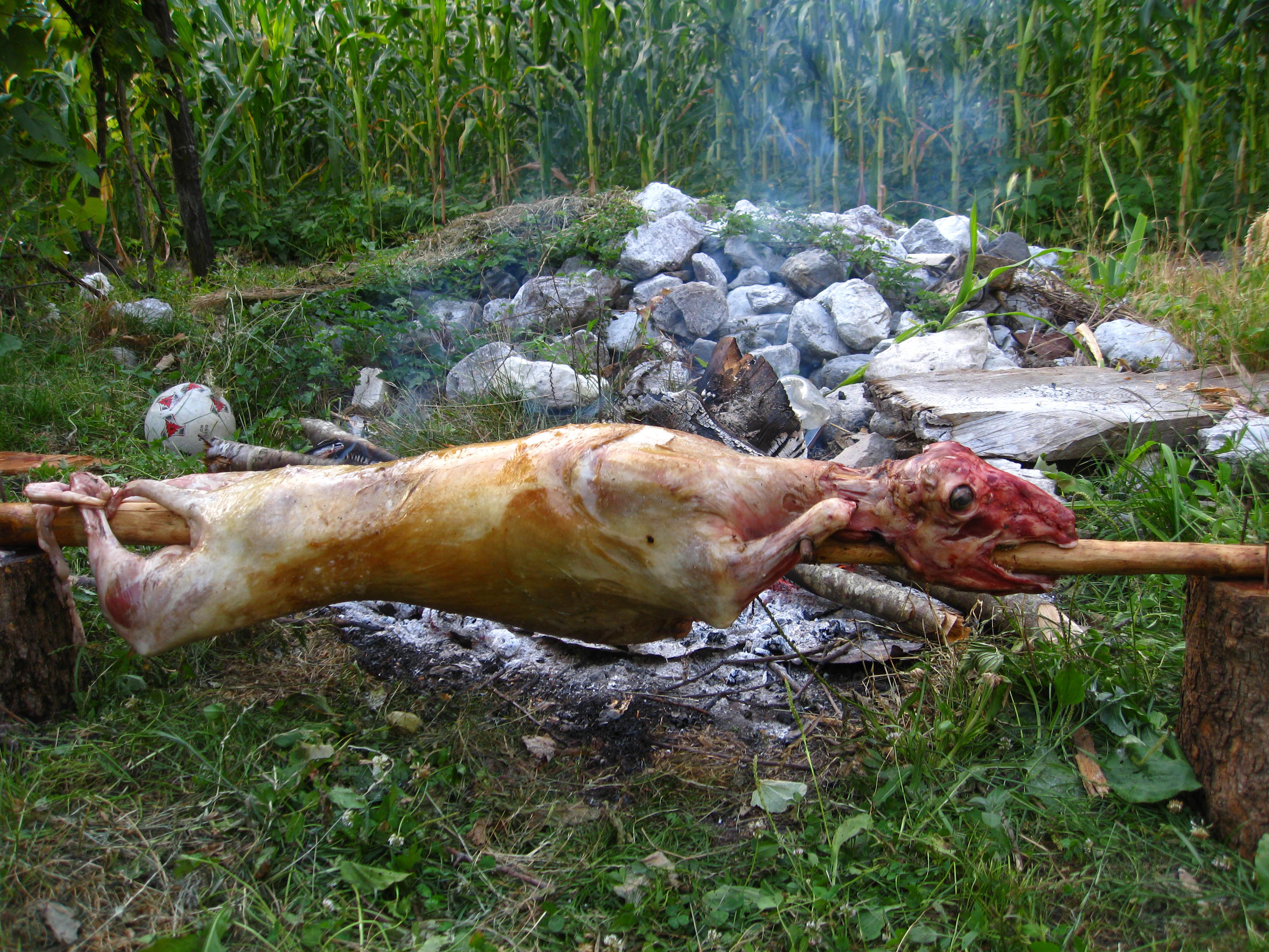
Dinner in Thethi
Cultural or Archaeological Interest
- The best that could happen to the Tirana Pyramid 2014.
- Kruja, an old small town on a hillside not far from Tirana, with the only functioning market for souvenirs and antiques. While everybody visits Kruja, few climb the face of the mountain to visit the Bektashi temple on the top of mountain
- Illyrian Stones and a Lofty Summit (592 Meter) - the secret treasures of Petrelë
- Dorez Castle (474 Meter). A lake, a castle, nice trails and excellent views.
- Pay a visit to the ruins of Varoshi Castle (377 Meter). A short drive from Tirana, and a short walk, soak up some views and impressions of village life.
- Kepi i Rodonit (204 meter) - not much 4-wheeling, but a very nice excursion from Tirana. A cape with steep cliffs, an ancient church and the remains of a castle
- Vrap - three mountains (671 Meter) and old graveyards
- Easily reached and only a short excursion, Bashtovë is worth a side trip. We give directions as many seem to miss the point!
- Apollonia was an ancient Greek city and colony in southern Illyria. It was founded in 588 BC from Kerkyra (Corfu) and Corinth, and was perhaps the most important of the several classical towns known as Apollonia. Its ruins are situated near Fier.
- Churches of Ardenica, Libofshe and Shen Kosmas - and a little optional offroad drive
- Byllis has been one of the largest ancinet town in souther Illyria - and can now also be accessed from the new Fier - Gjirokaster highway
- The historic site of Berat, also a world heritage site. The town is still renowned for its historic architecture and scenic beauty and is known as the "Town of a Thousand Windows", due to the many large windows of the old decorated houses overlooking the town.The Citadel overlooks the river and the modern city as well as the old Christian quarter across the river. It is a well preserved area containing narrow streets, Turkish houses and Orthodox churches.
- Via Egnatia, Ancient Graves at Selcë and Guri i Zi
- The old city of Gjirokaster, a world heritage site. Its old town is described as "a rare example of a well-preserved Ottoman town". The city is overlooked by a large castle, the Kalaja e Gjirokastres.
- Visit several treasures near Gjirokastra, good for a rainy day, or a sunny day: Antigoneia, Hadrianopolis, and St. Mary at Lobova e Kryqit and more
- You hear about Voskopoje, but have you been there?
- Inhabited since prehistoric times, Butrint has been the site of a Greek colony, a Roman city and a bishopric. Following a period of prosperity under Byzantine administration, then a brief occupation by the Venetians, the city was abandoned in the late Middle Ages after marshes formed in the area.The historic site of Butrint, possibly the oldest settlement in Albania.
- Also the north has its share of cultural interest. See for instance Kulla e Markes near Peshkopi.
Other Interesting Locations
- Visit Petrela Castle, with its restaurant, for an enjoyable view over Tirana. Remember, you also can walk here from Tirana
- Kokomani Winery is somewhere betwen Tirana and Durres, and specializes in the Shesh grape.
- Thethi. A stroll to Thethi's most important sights, with a short hike to the Grunas waterfall and canyon.
- Valbona Valley. The valley is best reached by way of the Komani Ferry, and porvides beautiful alpine scenery. The big Ferry is gone, but you can still travel with smaller boats (though without your car)
- Tthe Vermosh Valley provides one of the most beautiful drives in Albania, and Lepushe might be village in the vally to linger fo a while
- Between the coastal Albanian cities of Vlore and Himare is the famous Llogara Pass a winding alpine road, rising to 1,027m and overlooking the Albanian riviera. It has astonishing vistas and often has amazing cloud formations. You may also climb Maja e Qorres (2018 Meter) from here. If you do, consider spending a night in one of the hotel on or near the Llogara Pass.
- Sarande, the southernmost coastal town, at the Ionian Sea, opposite the Greek island of Korfu
- The Blue Eye - a marvelous spring located between Sarande and Gjirokaster
- The long, winding road from Gjirokastra to Korca along the border to Greece is little used, but provides fantastic vistas, especially to Mount Nemercke
- Or continue towards Prespa Lake, for a change of scenery
- The drive from Rreshen to Burrel, in the rainy season, requires good stamina. But you get very nice views of Mali e Dejes, a rather mysterious mountain
- Nearby Tirana, Maja e Rakshanit (930 Meter) has stunning views onto Kruja Mountain, and makes a river disappear.
- Rather than dreaming of the Lura Lakes, why not going there?
- Sotirë Water Falls (418 Meter) near Gramsh, at the foot of Tomorri Mountain. Soon, you may be able to drive to the falls....
Travelling in Albania
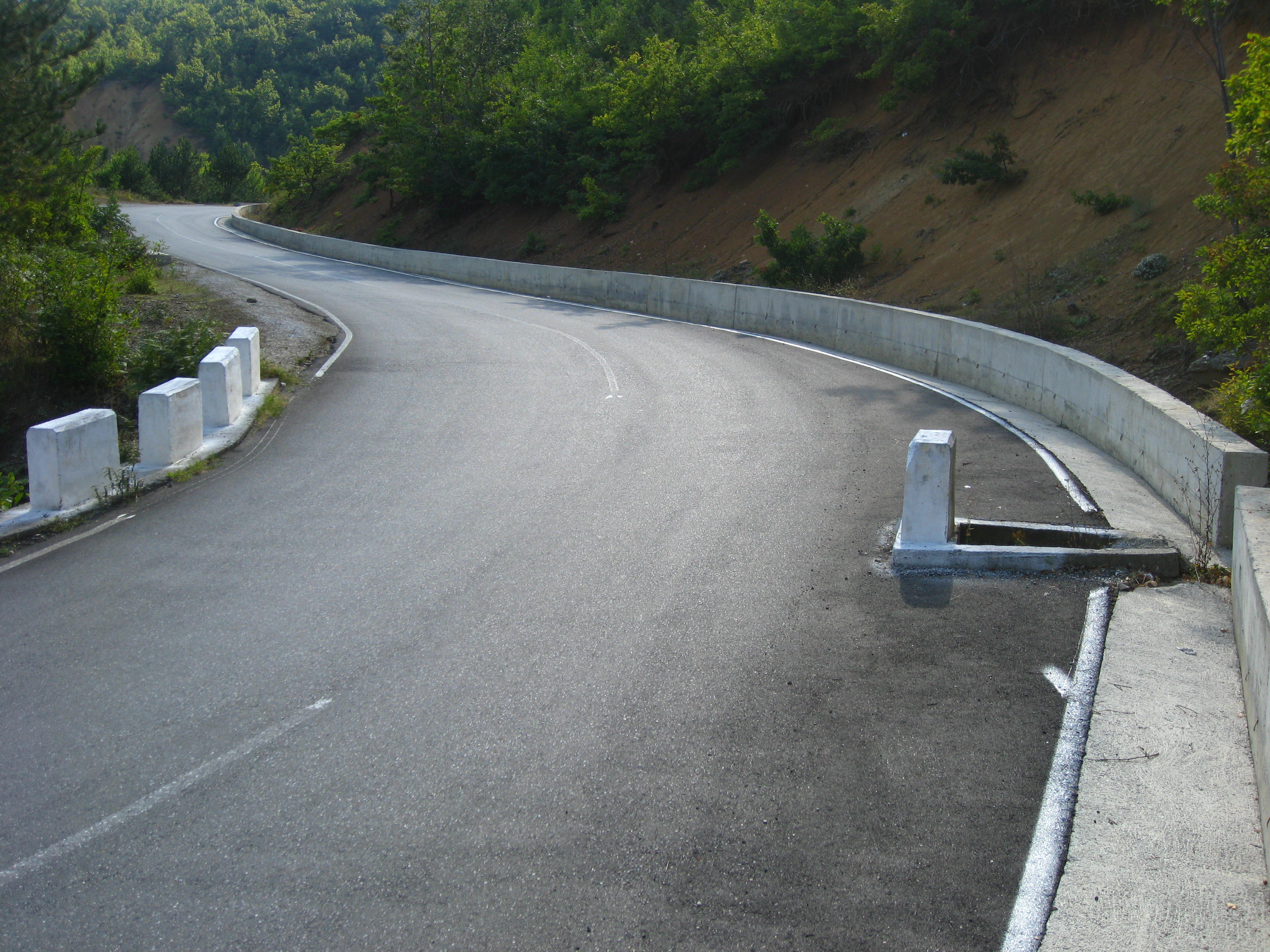
Albania is the country of beautiful Mountain Roads, which sometimes can be a heartstopping experience. Even literally, as the picture below shows... Memorials for unlucky drivers, passengers or pedestrians follow you everywhere.
Road conditions can change quick and dramatically - and if possible some local advise should be obtained before attemtping a road that has been described some time ago. This may work both ways: Sometimes a once difficult dirt road requiring a high clearance vehicle is now a beatiful rural asphalt road. Sometimes, a beautiful asphalt road has been washed out and requiring long detours. And any rough road may become worse or better than described, depending on local maintenance work.
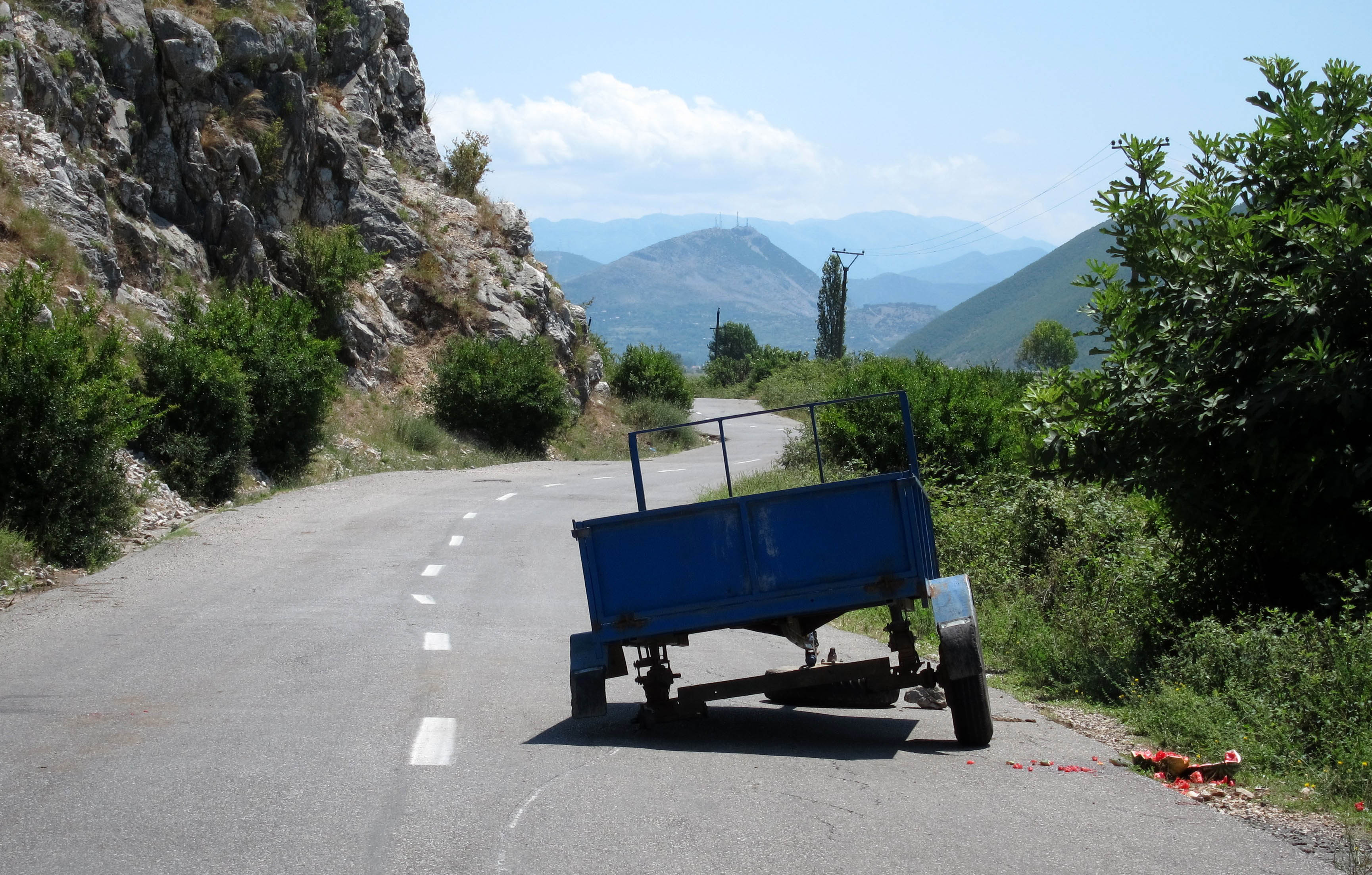
Straight to Gramsh, left to Llixha
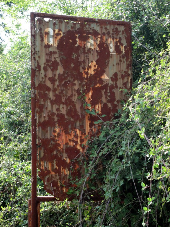
Curiosities
Albania offers much of interest to the visitor, including real curiosities. For instance, during communist times, the regime had built hundred of thousand of bunker pillboxes, part of a self-defense strategy against enemies that never came. According to experts, the bunkers would have been very effective to defend the country against intruders.
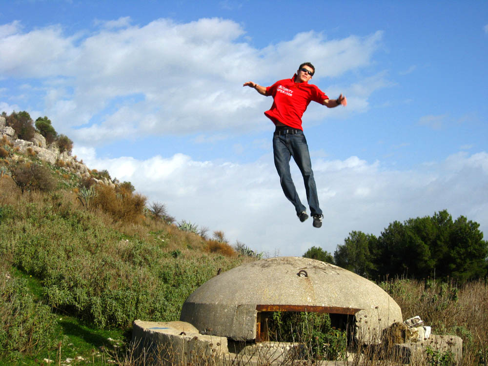
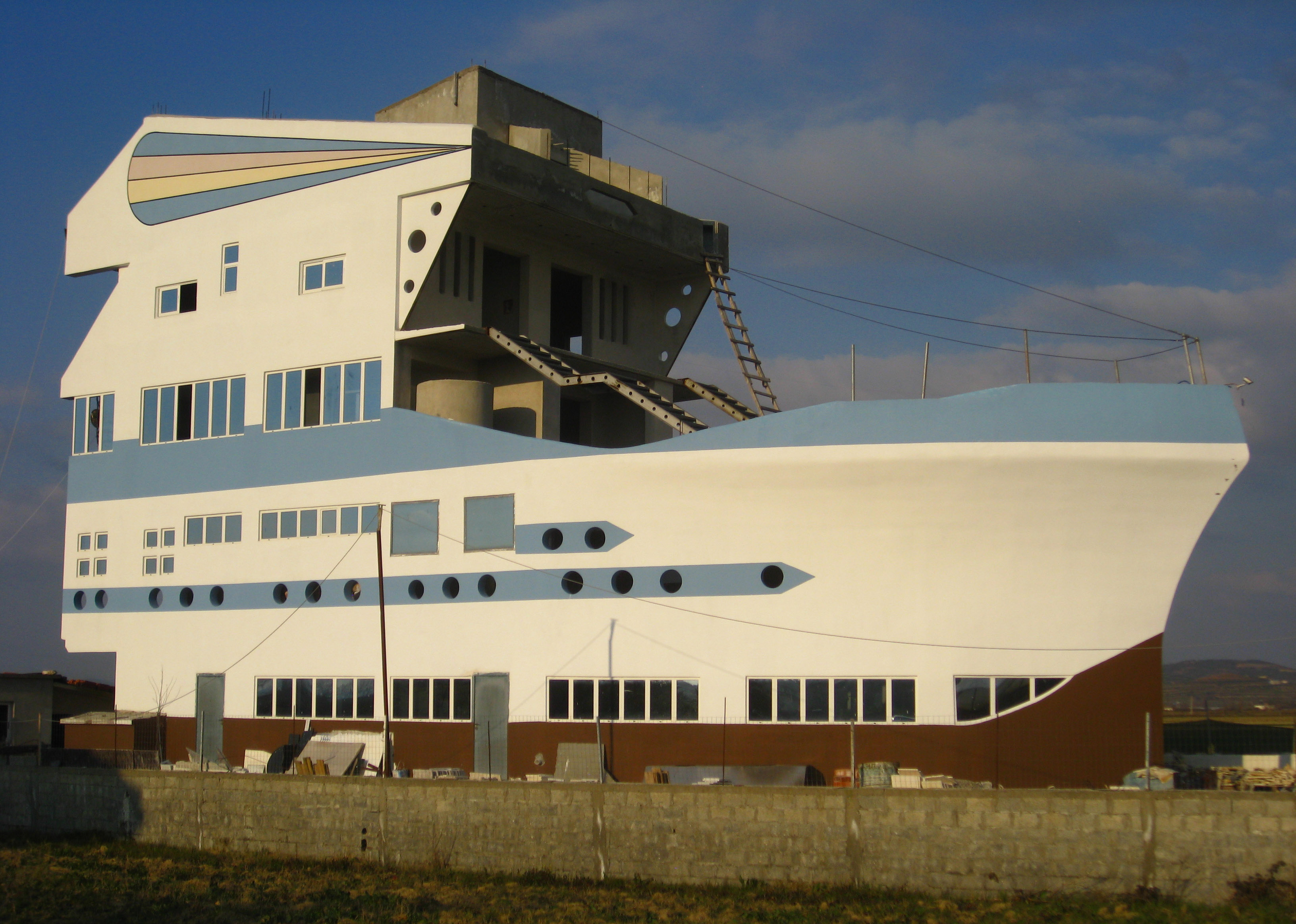
Someone flew over the bunkernest ship run on ground
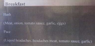
Breakfast Menu in Hotel
Literature
Ismail Kadare (born January 28, 1936) is the Albanian writer/novelist. In 1996 he became a lifetime member of the French Académie des Sciences morales et Politique, where he replaced the famous philosopher Karl Popper. In 1992, he was awarded the Prix mondial Cino Del Duca; in 2005, he won the inaugural Man Booker International Prize and in 2009 the Prince of Asturias Award of Literature. He has divided his time between Albania and France since 1990. He is a Nobel Prize in Literature candidate.
If you like Kafka, you'll like Ismail Kadare!
Found a Parking Place
Resources
-
 for those equipped with GPS, perhaps the ultimate site for searching trails and trail information for hiking, mountaineering, offroading, canoeing and so on. Check out "Palmtreeproduction" on Wikiloc! Waypoints and trails can be downloaded directly from Wikiloc to your GPS unit..
 - Summitpost.org - a good website for almost all your mountaineering needs outside Albania
- http://travelingluck.com - the website for finding the name of the most unobstrusive hill, or the tiniest village. While it is good on coordinates, it doesn't give altitudes.
- If you haven't seen it on Google Earth, you haven't seen it. Particularly worhtwhile when "wikiloc" is enabled (under gallery). Don't miss the 3D views in Google Earth, which can also provide a good estimation of the real ups and downs of a trail.
- GPS Babel is a handy programme to convert GPS information from one proprietary system to another.
- Vist Endrit's Trails at his blog site for additional hikes and intersting information about Albania
- Facebook link to the Shoqata "DAJTI" Alpino-Turistike (a club of Albania mountaineers)
- Albinfo provides a detailed photographic map of Albania, with an asyonishing resolution. It is a little clumsy to use, but once you got the hang of it it can be useful
- outdooralbania.com can organize adventures, and appears to be a environmentally and ecologically responsible company.
/IMG_1203%20small.jpg)
Near Thethi
How big is a Mountain?
- The "prominence"or the "primary factor" of a mountain is not determined by its absolute altitude, but by the minimal vertical drop that one has to descend before ascending a higher mountain.
- Of the 100 European mountains with the biggest prominence, six are located in Albania. This is another way of saying that there is a lot of up and down in Albania!
- These six mountains are Korab, Jezerce, Nemercka, Kendervices, Cikes, and Valamares.
- More information on prominence, primary factors, and those Albanian mountains can be found on the website "The European 100 Finest" by Petter Bjorstad.
Travel
-
Books on the latest history, and travel guides are increasingly available, but - because of 50 years of isolation - are still rare compared to most other countries. The Bradt Travel Guide stands out as very useful. The few available maps often provide conflicting information and it is best to consult local expertise. This also is easier said than done, as English (or German) is not very widely spoken.

-
Omnimaps has a selection of maps of Albania, some even for downloading.
-
If you have a Garmin compatible GPS, download the Albania geo-political basemap from Bunkertrails, accurate to 10 meter also in contours.
-
The Thethi and Kelmend Wanderkarte (50,000:1) is good for roadtravel in much of Northern Albania. Comes with a guidebook

UNICEF Albania
-
Check out the website of UNICEF Albania, for information on UNICEF's support to the Government of Albania, including some photo-essays